Login
Login
NASA Awards First Prize in Phase 2 of Agency’s LunaRecycle Challenge
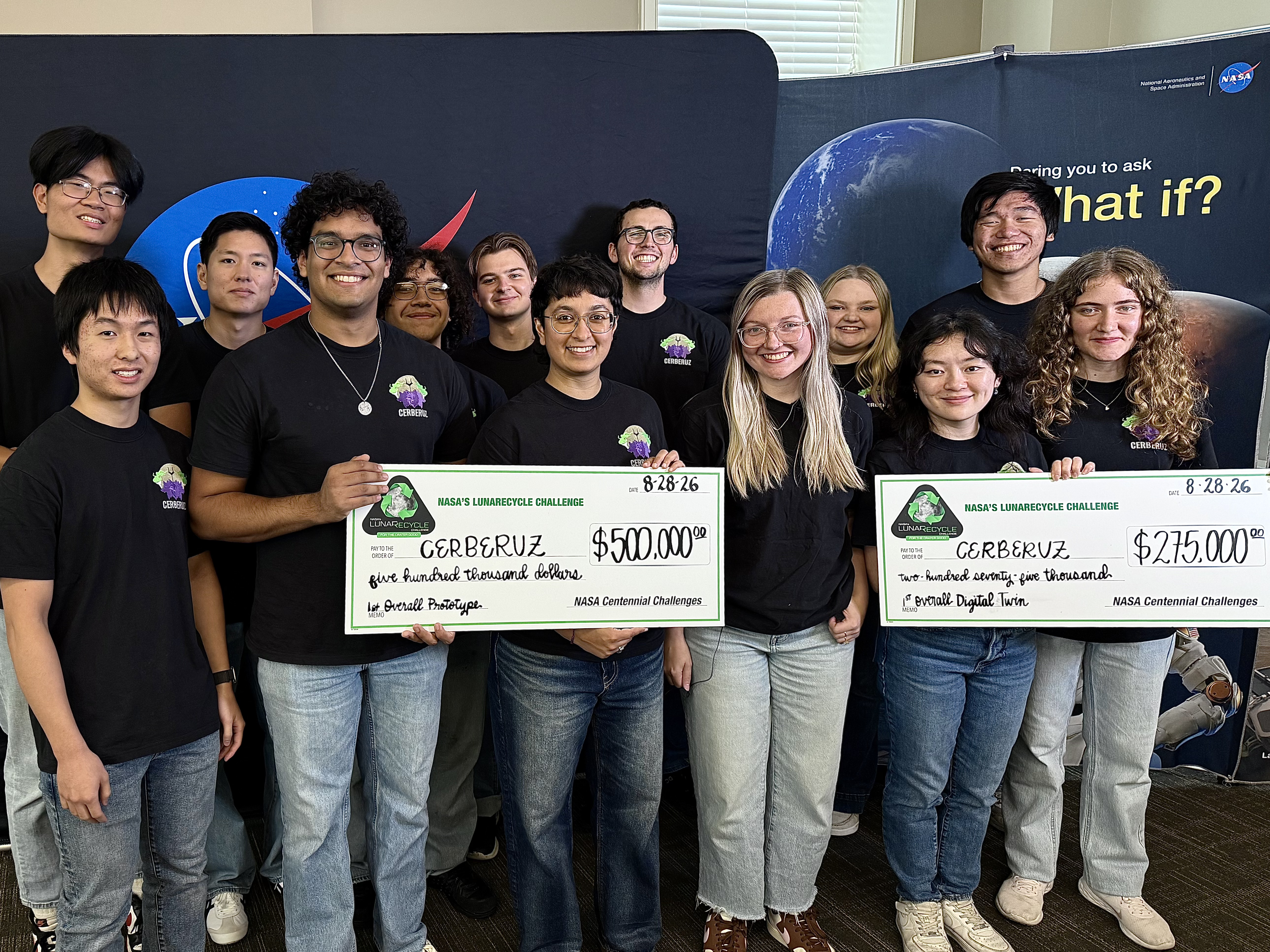
NASA named a team from the Massachusetts Institute of Technology (MIT) as the first prize winner for Phase 2 of the agency’s LunaRecycle Challenge, which focused on developing solutions for reducing waste during missions to the Moon or deep space by recycling common materials, like fabrics, plastics, foam, and metals.
The Composites for Extraterrestrial Recycling By Engineering the Reuse and Upcycling of Zotek (CERBERUZ) team, comprised of undergraduate, graduate, and doctoral students at MIT, received a total of $775,000 in awards.
The technology grinds mixed trash into a fine powder, repurposing materials such as Zotek foam as reinforcement rather than treating it as contamination that needs to be sorted out. The powder becomes feed for use as injection-mold finished parts or 3D-printing filament. The MIT team won in both the competition’s prototype development track and in the track focused on developing virtual models, known as “digital twins,” of recycling systems.
“The LunaRecycle Challenge finale is the culmination of two years of innovation spurred by this competition,” said Jennifer Edmunson, program manager for Centennial Challenges at NASA’s Marshall Space Flight Center in Huntsville, Alabama. “It’s incredible to see these technologies go from concept to prototype and digital twin demonstrations in that time. Driving rapid and creative innovation is what NASA challenges are all about.”
LunaRecycle is a $3 million, two-phase competition in partnership with The University of Alabama Lee J. Styslinger Jr. College of Engineering. Phase 2 of the competition required U.S. teams to submit a prototype, with an optional digital twin serving as a virtual model of it.
For Phase 2, 14 finalist teams from across the United States gathered at The University of Alabama’s Lee J. Styslinger Jr. College of Engineering, in Tuscaloosa, from Aug. 24 to Aug. 28 to demonstrate their technology prototypes. The digital twin models submitted by some teams were also presented alongside their respective prototypes.
The competitors’ backgrounds ranged from university students and faculty to entrepreneurs and space technology enthusiasts. Teams were encouraged to envision solutions that not only addressed recycling in deep space, but that also could have applications on Earth.
Along with the first prize winner, nine teams received prizes:
Prototype track winners:
- Second place overall ($225,000): Terasynth from Orlando, Fla. with Lunar Re-Forge System
- Most Innovative ($50,000): RECLAIM from Penn State University with the Resource Extraction and Conversion from Lunar Anthropogenic Inputs with Microwaves (RECLAIM) system
- Highest Mass Efficiency ($50,000): Cislune from Rosemead, Calif. with the Carbon Recovery and Feedstock Transformation for Extraterrestrial Reuse (CRAFTER) system
- Most Trash Types Recycled ($50,000): Team Lovegrove from Bob Jones University in Greenville, S.C. with LunaBrix
Additional digital twin track winners:
- Second place overall ($125,000): Moon Made from Boulder, Co. with Fiber Forge
- Most Innovative ($25,000): RECLAIM from Penn State University with the RECLAIM system
- Best Visualization ($25,000): Waste Parrot Technologies from New York, N.Y.
People’s choice winner ($25,000):
- Terasynth from Orlando, Fla. with Lunar Re-Forge System
“This competition highlights how collaborations can lead to incredible solutions,” said Chris Frangione, who manages the LunaRecycle Challenge in support of NASA Centennial Challenges contracted through Amentum Space Exploration Division. “Between the solver teams, The University of Alabama, and NASA, this finale showcases what can be achieved when we bring together resources and great ideas towards a common goal.”
The Phase 2 awards follow the success of the competition’s Phase 1, which received record-breaking interest from the global innovator community with more than 1,200 registrations – more than any competition in the 20-year history of NASA Centennial Challenges. For Phase 1, which concluded in 2025, participants from around the world could submit designs in either or both of the prototype or digital twin tracks. A panel of 50 judges evaluated nearly 200 Phase 1 submissions, selecting 17 teams representing five countries and nine U.S. states as winners. Phase 2 entries were required to be unrelated to Phase 1.
The LunaRecycle Challenge is managed at NASA’s Marshall Space Flight Center by Centennial Challenges, part of the Prizes, Challenges, and Crowdsourcing program within NASA’s Research and Technology Mission Directorate. NASA’s Centennial Challenges have a legacy of more than 20 years engaging the public to solve complex problems that benefit NASA’s broader initiatives. Past challenges have spurred advances in robotics, additive manufacturing, power and energy, textiles, chemistry, and biology.
LunaRecycle is also supported by subject matter experts at NASA’s Kennedy Space Center in Florida, NASA’s Ames Research Center in California’s Silicon Valley, and NASA’s Langley Research Center, in Hampton, Virginia.
To learn more about LunaRecycle, visit: