Reading view

There are new articles available, click to refresh the page.

NASA’s Juno Takes Temperature of Jupiter’s Fiery Moon Io

5 min read

Preparations for Next Moonwalk Simulations Underway (and Underwater)

A view of half of the sphere of Jupiter’s volcanic moon Io against black space. The surface is colorful pinkish-tan and mottled with dark brownish features and sharp peaks surrounded by bright white diffuse deposits.
TThe north polar region of Jupiter’s volcanic moon Io was captured by NASA’s Juno during the spacecraft’s 57th close pass of the gas giant on Dec. 30, 2023. Data from that flyby and one on Feb. 3, 2024, is helping scientists understand Io’s interior.
Image data: NASA/JPL-Caltech/SwRI/MSSS Image processing by Gerald Eichstädt

Lee esta historia en español aquí.

 NASA’s Juno mission has provided the first measurements of the temperature below the surface of Jupiter’s moon Io, revealing significant heating within the shallow subsurface of the most volcanically active world in the solar system. Collected during two close flybys, the data also shows that most of Io’s surface is remarkably smooth and composed of material of very low density.

Published Wednesday in the Journal of Geophysical Research: Planets, these findings break new observational ground for both fiery and icy worlds beyond our planet.

Io’s extreme volcanism is powered by tidal heating. The moon is constantly stretched and squeezed by Jupiter’s immense gravity as it travels its slightly elliptical orbit, generating internal heat output many times greater than Earth’s. Until now, virtually everything known about that heat came from infrared observations, which sense only the temperature of the top surface. The latest findings are derived from data collected by the spacecraft’s Microwave Radiometer (MWR) instrument.

“The Juno Microwave Radiometer directly observed Io’s heat output by looking below the surface,” said Scott Bolton, study coauthor and Juno’s principal investigator at Southwest Research Institute in San Antonio. “The surprising discovery that we could see below a rocky moon’s surface has important implications for studying Earth’s volcanoes. Juno has taught us that if we look with an MWR-type instrument near a volcano on Earth, we might see a similar signature in the subsurface temperature gradient, providing new information on how terrestrial volcanoes work.”

A global map of Jupiter’s moon Io featuring a color-coded overlay and latitude and longitude gridlines. Red appears in the upper and center left, yellow in the middle, and green across the top.
This map represents data captured by the Microwave Radiometer instrument aboard NASA’s Juno, indicating heat rising from just beneath the surface of Jupiter’s moon Io. The colors illustrate a distinct temperature gradient across the moon, with the most extreme, localized heat output in red.
NASA/JPL-Caltech/SwRI/USGS

Fire, ice

Juno’s Microwave Radiometer was designed by Bolton to peer beneath Jupiter’s cloud tops to investigate the dynamics and composition of the gas giant’s deep atmosphere. The MWR’s six microwave antennas serve as a single instrument, simultaneously detecting microwaves at a wide range of wavelengths, from about half an inch to 20 inches (1.3 to 51 centimeters). During the mission’s extended phase, the MWR instrument has provided the opportunity to observe three of the planet’s Galilean moons: Ganymede, Europa, and Io.

“The technique is novel in that each wavelength explores different depths, providing a new way to characterize the deep atmosphere of giant planets and the subsurface crusts of icy and rocky moons,” said Bolton. “At Ganymede and Europa, we explored tens of miles below the surface, assuming their ice shells were mostly pure water, but the ability to probe into the volcanic rock at Io was an unexpected discovery.”

During flybys on Dec. 30, 2023, and Feb. 3, 2024, the solar-powered Juno spacecraft came within about 930 miles (1,500 kilometers) of the moon’s surface.

“The instrument measured Io’s thermal emission at depths ranging from a few inches down to tens of feet. Everywhere we looked, we found the temperature rising by more than 40 degrees Fahrenheit just several feet into the surface — a gradient far steeper than solar heating alone can explain,” said Shannon Brown, the paper’s lead author at NASA’s Jet Propulsion Laboratory in Southern California.

The data suggests two possible explanations. First, heat could be rising steadily through a conductive crust. While this background heat flow — measured at 1 to 3 watts per square meter — is relatively gentle on a local scale (roughly equivalent to a small nightlight glowing under every square yard), across the entire moon it represents a release of energy up to 30 times Earth’s average. Alternatively, the signal could be coming from cooling lava flows, capped by roughly 30 to 35 feet (9 to 11 meters) of solidified crust, that cover about 10% of the moon’s surface at any given time.

“Io provides a unique window into learning how tidal heating works throughout the cosmos, a fundamental process that provides energy and heat to worlds that are far from their parent star,” said Bolton. “This process can not only create the most volcanic body in the solar system, in the case of Io, but also fuels the subsurface oceans on the moons of giant planets, such as Europa and Ganymede. Up until this point we could only observe the heat escaping at the surface or through eruptions. Now we can characterize how the heat is moving from the interior toward the surface.”

A spherical projection of Io overlaid with a latitude and longitude grid. Broad, curved tracks — composed of overlapping ellipses crossing the surface — are black across the center and left of the globe, transitioning to blue toward the lower right.
This graphic illustrates the areas of Io sampled by the Microwave Radiometer instrument aboard NASA’s Juno spacecraft during two close flybys of the Jovian moon.
NASA/JPL-Caltech/SwRI/USGS

Great plains of Io

Another big insight gained from the two flybys is just how smooth Io is. Prior to the recent findings, the moon was known for its tall mountains, but the MWR indicates that apart from this visible topography, the surface features expansive smooth patches that stretch for 60 miles (100 kilometers) or more. Because Juno flew by overlapping regions of Io at different angles, the team was able to map how the surface reflects microwaves, much like an airline passenger might see the ocean flash with sunlight only at specific angles.

“Away from its mountains, the surface is more like the Great Plains of North America, and even though Io is a rocky body, the surface material has a very low density — more like pumice or a fluffy volcanic ash than solid rock,” said Brown.

More about Juno

A division of Caltech in Pasadena, California, JPL manages the Juno mission for the principal investigator, Scott Bolton, of the Southwest Research Institute. Juno is part of NASA’s New Frontiers Program, which is managed at the agency’s Marshall Space Flight Center in Huntsville, Alabama, for the NASA’s Science Mission Directorate in Washington. Lockheed Martin Space in Denver built and operates the spacecraft. More information about Juno is at:

https://science.nasa.gov/mission/juno

News Media Contacts

DC Agle
Jet Propulsion Laboratory
818-393-9011
agle@jpl.nasa.gov

Karen Fox / Molly Wasser
NASA Headquarters, Washington
202-358-1600
karen.c.fox@nasa.gov / molly.l.wasser@nasa.gov

Deb Schmid 
Southwest Research Institute, San Antonio 
210-522-2254 
dschmid@swri.org 

2026-050

Share

Details

Last Updated
Jul 22, 2026

NASA to Host Media Briefing on Roman Telescope, Launching Next Month

A large silver and gray space telescope sits in a brightly lit, white clean room. Team members in blue suits work on the telescope from orange mechanical lifts.
Technicians and engineers at NASA’s Kennedy Space Center in Florida use a crane to lift the agency’s Nancy Grace Roman Space Telescope to a specialized work stand June 26, 2026, as the mission prepares to launch nine months ahead of schedule. The Roman Space Telescope will offer a field of view at least 100 times larger than the Hubble Space Telescope’s, resulting in deep, sweeping explorations of the cosmos.
Credit: NASA/Sydney Rohde (Rocz)

Media are invited to join NASA for a virtual news conference at 2 p.m. EDT, Wednesday, July 29, to preview the Nancy Grace Roman Space Telescope mission, scheduled to launch from the agency’s Kennedy Space Center in Florida on Sunday, Aug. 30.

NASA will stream this event live through a variety of platforms. Learn where to watch online: https://www.nasa.gov/live.

Participants in the briefing, who will provide an overview of the mission and its status, include:

  • Shawn Domagal-Goldman, director, Astrophysics Division, NASA Headquarters in Washington
  • Jackie Townsend, Roman telescope project manager, NASA’s Goddard Space Flight Center in Greenbelt, Maryland
  • Julie McEnery, Roman telescope senior project scientist, NASA Goddard
  • Jeremy Perkins, Roman telescope integration and test scientist, NASA Goddard

Media interested in participating by phone must RSVP no later than two hours prior to the start of the briefing to Rob Garner at rob.garner@nasa.gov. A copy of NASA’s media accreditation policy is online.  

Named after NASA’s first chief astronomer, the Nancy Grace Roman Space Telescope will have a deep, panoramic view of the cosmos, generating never-before-seen pictures that will revolutionize our understanding of the universe. The observatory will usher in a new era of cosmic surveys, unveiling troves of celestial objects and shedding light on some of the universe’s most profound mysteries, including phenomena we can’t see. Roman also will showcase cutting-edge technology, including a test of the most advanced technology ever flown in space to directly image planets around nearby stars, a key step in NASA’s search for life on other worlds.

The Roman telescope is managed at NASA Goddard with participation by the agency’s Jet Propulsion Laboratory in Southern California; Caltech/IPAC in Pasadena, California; the Space Telescope Science Institute in Baltimore; and a team of scientists from various research institutions. The primary industrial partners are BAE Systems Inc., L3Harris Technologies, and Teledyne Scientific & Imaging. Contributions to Roman also are made by ESA (European Space Agency), JAXA (Japan Aerospace Exploration Agency), the French space agency CNES (Centre National d’Études Spatiales), and the Max Planck Institute for Astronomy in Germany.

For more information about NASA’s Roman telescope, visit:

https://nasa.gov/roman

-end-

Alise Fisher
Headquarters, Washington
202-358-2546
alise.m.fisher@nasa.gov

Claire Andreoli / Rob Garner
Goddard Space Flight Center, Greenbelt, Md.
301-286-1940 / 301-286-5687
claire.andreoli@nasa.gov / rob.garner@nasa.gov

US-India Satellite Delivers Data, Reveals ‘Hummingbird’ in Antarctica

Main
Figure A
Scientists used data from the L-band radar aboard the U.S.-India Earth-orbiting NISAR satellite to produce this image of Nunatak Zaterjavshijsja, a mountaintop in East Antarctica, poking out amid a stream of ice flowing northeast to the ocean.
NASA/JPL-Caltech
The image shows Nunatak Zaterjavshijsja at center-left, surrounded by ice fractured with crevasses, which are shown as sharp, green lines. The magenta portions of the image represent more regular surfaces, such as smooth ice.
NASA/JPL-Caltech
Scientists used data from the L-band radar aboard the U.S.-India Earth-orbiting NISAR satellite to produce this image of Nunatak Zaterjavshijsja, a mountaintop in East Antarctica, poking out amid a stream of ice flowing northeast to the ocean.
NASA/JPL-Caltech
The image shows Nunatak Zaterjavshijsja at center-left, surrounded by ice fractured with crevasses, which are shown as sharp, green lines. The magenta portions of the image represent more regular surfaces, such as smooth ice.
NASA/JPL-Caltech
Main
Figure A

NISAR’s L-Band Radar Reveals ‘Hummingbird’ in Antarctica

Scientists used data from the L-band radar aboard the U.S.-India Earth-orbiting NISAR satellite to produce this image of Nunatak Zaterjavshijsja, a mountaintop in East Antarctica, poking out amid a stream of ice flowing northeast to the ocean. The annotations point out the sharp green lines that indicate ice fractured with crevasses. Magenta represents more regular surfaces, such as smooth ice. Credit: NASA/JPL-Caltech

As of July 20, the public can access data from the two powerful radar instruments aboard the NISAR (NASA-ISRO Synthetic Aperture Radar) satellite. Teams in the United States and India will release files processed from the satellite’s L-band and S-band radars on an ongoing basis, helping researchers and other users track the movement of Earth’s land and ice masses, monitor changes in ecosystems like forests and wetlands, and respond to natural hazards such as landslides and earthquakes. 

The release comes as NASA and ISRO (Indian Space Research Organisation) prepare to celebrate the first anniversary of NISAR’s July 30, 2025, launch from India’s Satish Dhawan Space Centre. Since that time, the mission engineering and science teams have been busy calibrating instrumentation, refining algorithms, and monitoring nearly all the planet’s land- and ice-covered surfaces twice every 12 days. Along the way, the team has captured scenes from around the globe — urban street grids, agricultural fields, landslides, earthquakes, and sinking land in Mexico City.  

An early image released Tuesday revealed the fractured, barren surface of an Antarctic landscape in stark detail. In a merging of science and serendipity, it also resembles something else entirely: a hummingbird. 

Despite its otherworldly quality, the Antarctic image shows a very real geographical feature called Nunatak Zaterjavshijsja, a mountaintop in East Antarctica, poking out amid a stream of ice flowing northeast to the ocean. As the moving glacier passes the obstruction, the mountain’s topography causes stresses in the ice, heavily fracturing the surrounding surfaces with deep cracks, called crevasses, which show as sharp green lines in the image.  

“First, it’s a beautiful image, with rich details of features that provide insights to how the glacier is moving. Then, because radar can often see through snow and deep into the ice, NISAR can observe fundamentally different properties of Antarctic ice than can be seen in optical imagery,” said Seongsu Jeong, the signal analysis engineer who produced the image at NASA’s Jet Propulsion Laboratory in Southern California. “With NISAR we’re seeing what’s hidden beneath the surface.” 

Story in magenta, green 

Generated with measurements that NISAR’s L-band instrument gathered in August 2025, as U.S. and Indian mission teams tested the satellite’s systems, the “hummingbird” exemplifies one of the young mission’s hallmarks: intricately detailed imagery that is both informative and eye-catching.  

The colors show differences in the way polarized microwave signals, which vibrate in different directions, interact with and reflect from the ice. Over Antarctica, NISAR transmits radar waves toward Earth with a horizontal polarization. The orientation of the signals that return — either horizontal, vertical, or both — provide clues about the object or surface that reflected them. 

Signals that come back with a horizontal polarization likely bounced off a more regular surface, such as smooth ice. Those signals appear magenta in the image. Signals that return with vertical polarization may have refracted as they partially penetrated the snow and ice or scattered at different angles as they reflected off irregular surfaces, such as the faces of crevasses. Called volume scattering, these observations are displayed in green. 

The white represents areas in which magenta and green signals scatter back strongly, a possible indication that there is an equal blend of surface and volume scattering. 

The same scene viewed in optical light is almost entirely white with ice and snow. Slight shadows and rippling indicate the presence of the mountaintop, and textures in the surrounding area suggest the ice is not completely smooth. 

An image from the Landsat 9 satellite shows Nunatak Zaterjavshijsja on Nov. 2, 2025. Because microwaves can penetrate frozen surfaces, signals from NISAR’s L-band radar captured more detail of the structure of the surrounding icescape than is visible in this optical image.
USGS

Access to data 

The NISAR satellite is the first free-flying space mission to feature two radar instruments: an L-band system and an S-band system. The systems are complementary due to their differing wavelengths. For example, the longer-wave L-band can pass through tree canopies, imaging the ground beneath. Meanwhile, depending on leaf sizes, S-band can collect observations of those canopies. 

The Indian science team, based at ISRO’s Space Applications Centre in Ahmedabad, recently started releasing S-band data via the Bhoonidhi portal.  

On July 20, the U.S. side of the mission started releasing calibrated products continuously for all L-band measurements collected since June 17. By the end of the year, the team expects to have released all data acquired earlier during science operations. The NISAR project science team previously had two limited releases of L-band data, the first in January of about 25 sample products and a release in February of thousands of pre-calibrated products. 

As with the earlier releases, data users will be able to download the latest files at the Alaska Satellite Facility Distributed Active Archive Center in Fairbanks, which hosts and distributes all NASA synthetic aperture radar data.  

The NISAR mission’s science data output is vast, on the order of dozens of terabytes a day, due to the satellite’s frequent coverage of nearly all the land and ice surfaces on Earth. It scans from within a few degrees of the South Pole in Antarctica to 77.5 degrees north latitude, above the Arctic Circle. 

More about NISAR 

Managed by Caltech, JPL leads the U.S. component of the project and provided the satellite’s L-band SAR and antenna reflector. The spacecraft bus and its S-band SAR were provided by ISRO. 

The NISAR satellite is the first to carry two SAR instruments at different wavelengths, collecting data using the spacecraft’s giant drum-shaped reflector, which measures 39 feet (12 meters) wide — the largest radar antenna reflector NASA has sent into space. 

To learn more about NISAR, visit: 

https://science.nasa.gov/mission/nisar/

Media Contacts

Andrew Wang / Andrew Good 
Jet Propulsion Laboratory, Pasadena, Calif. 
626-379-6874 / 818-393-2433 
andrew.wang@jpl.nasa.gov / andrew.c.good@jpl.nasa.gov 

2026-049

NASA Study Finds Near-Earth Asteroid Is Actually Comet

5 min read

Preparations for Next Moonwalk Simulations Underway (and Underwater)

A dark, cratered asteroid floats in deep space against a background of countless stars, while a bright, distant sun in the lower right casts a beam of light across its rugged surface.
This artist’s concept depicts a near-Earth asteroid with an elongated orbit. A few objects such as these can exhibit significant perturbations in their motion around the Sun and, like the asteroid 1998 SH2, could turn out to be regular comets with a weak tail and coma (the gas and dust around a comet’s nucleus).
NASA/JPL-Caltech

New research led by scientists at NASA’s Jet Propulsion Laboratory in Southern California has revealed the identity of a puzzling near-Earth object by precisely tracking its motion through space and using powerful observatories that image faint celestial objects.

This object has a dual personality: Past images hadn’t revealed obvious cometlike activity, suggesting it might be an asteroid, but its motion recently proved to be irregular like that of a comet. The scientists detailed their findings in a study published in the journal Nature Astronomy.

The puzzle began on Aug. 28, 2025, when the object, provisionally known as the asteroid 1998 SH2, passed safely within 2 million miles (3 million kilometers) of our planet during its 4½-year orbit around the Sun. Researchers looking to observe 1998 SH2 with NASA’s Deep Space Network (DSN) planetary radar system had calculated its position using data from previous orbits and factored in the effects that the gravity of the Sun and planets would have on its path. But when 1998 SH2 didn’t show up where they expected, they realized that something unanticipated had been influencing the object’s motion.

Object tracking

By using optical astrometry to precisely measure the object’s position in the sky, the researchers were able to identify the cause.

“After we measured the nongravitational perturbations affecting the motion of 1998 SH2 and recognized they weren’t compatible with the object being an asteroid, we suspected the object could be an active comet,” said Davide Farnocchia, a navigation engineer with NASA’s Center for Near-Earth Object Studies at JPL and study lead.

Although 1998 SH2’s orbit around the Sun had been well-tracked from 1998 to 2016, the object had completed two solar orbits without additional observations by telescopes until the 2025 DSN attempts. Analyzing all observations collected since the object’s discovery in 1998, researchers determined the perturbations to 1998 SH2’s motion and hypothesized that the object may be generating a small thrust by venting gas into space, causing it to deviate from its predicted path.

This venting results from the Sun heating ice mixed with rocky material, turning the ice into a gas. With regular comets, this activity forms a trademark bright tail and coma — the gas and dust surrounding a comet’s nucleus. But when an object produces gas and dust in much smaller quantities, its tail and coma may not be detectable to most observatories.

Tail, coma emerge

The August 2025 close approach to Earth of 1998 SH2 provided the perfect opportunity for the paper’s authors to gather observational evidence of visible cometary activity. They reached out to astronomers at the Canada-France-Hawaii Telescope, a 3.6-meter (12-foot) optical/infrared telescope near the summit of Mauna Kea, Hawaii, and the 1.5-meter (5-foot) European Southern Observatory’s Danish Telescope in La Silla, Chile, to observe. Astronomers at the powerful European Southern Observatory’s 8.2-meter (27-foot) Very Large Telescope on the Chilean mountain Cerro Paranal also tracked the object.

“The images we collected from these observatories showed a weak but clear tail, thus confirming that 1998 SH2 is, in fact, a comet,” said Olivier Hainaut, an astronomer with the European Southern Observatory and coauthor of the study. “That’s how science works — you form a hypothesis, and you set out to test it. This data is exactly what was needed to confirm our hypothesis that 1998 SH2 was a comet.”

As an outcome of the investigation, 1998 SH2 will receive an additional comet provisional designation, P/1998 SH2.

Planetary defense implications

The research also sheds light on another, even more unusual, class of objects called dark comets. Like 1998 SH2, dark comets exhibit significant irregularities, or perturbations, in their trajectory but lack other visible evidence of comet activity — there’s no coma, tail, or visible outgassing. These enigmatic objects fall into two distinct populations: larger ones with orbits similar to those of Jupiter-family comets (short period comets with highly elliptical, or eccentric, orbits), and smaller ones that orbit closer to the Sun. Since the 2016 discovery of the first dark comet, about a dozen more have been identified.

The paper’s authors suggest that many of the larger dark comets, which have orbits like 1998 SH2’s, could turn out to be regular comets if astronomers get the right opportunity to observe them with powerful telescopes capable of imaging incredibly faint objects. And by analyzing the motion of all near-Earth objects using precision astrometry data, researchers may reveal more comets that were previously designated as asteroids if they exhibit cometlike nongravitational perturbations. 

“This work shows the importance of continuously tracking near-Earth objects,” said Farnocchia. “Because of outgassing, the motion of comets is more significantly perturbed than that of asteroids. Detecting these perturbations can be an important diagnostic tool for planetary defense that will help understand which objects may be comets rather than asteroids, how their orbits evolve, and how that influences their Earth impact risks.”

Hunting for near-Earth objects

NASA’s upcoming Near-Earth Object (NEO) Surveyor will collect data that can be used to support this effort. The first space survey telescope to be built for planetary defense, this next-generation mission will seek out some of the hardest-to-find near-Earth objects, such as dark asteroids and comets that don’t reflect much visible light.

NASA’s Center for Near Earth Object Studies, the Goldstone Solar System Radar Group, and NEO Surveyor all are managed by JPL and supported by the agency’s Planetary Defense Coordination Office in Washington. Caltech in Pasadena manages JPL for NASA. The DSN receives programmatic oversight from the SCaN (Space Communications and Navigation) program office, also at NASA headquarters.

More information about planetary radar, NASA’s Center for Near Earth Object Studies, and near-Earth objects can be found at:

https://www.jpl.nasa.gov/asteroid-watch

News Media Contacts

Ian J. O’Neill
Jet Propulsion Laboratory, Pasadena, Calif.
818-354-2649
ian.j.oneill@jpl.nasa.gov

Karen Fox / Molly Wasser
NASA Headquarters, Washington
202-358-1600
karen.c.fox@nasa.gov / molly.l.wasser@nasa.gov

2026-046

NASA’s Perseverance Rover Reads Record of Ancient Mars Impacts

5 min read

Preparations for Next Moonwalk Simulations Underway (and Underwater)

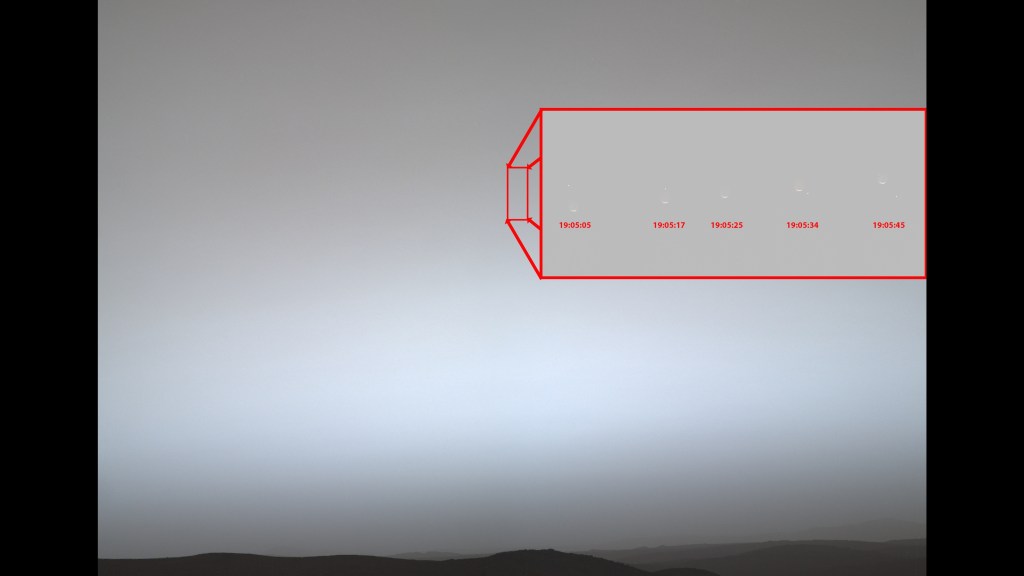
NASA’s Perseverance took this selfie at “Witch Hazel Hill” on Jezero Crater’s rim on May 10, 2025. The small dark hole in the rock in front of the rover is the borehole made when the rover collected the “Bell Island” sample. The small puff of dust left of center and below the horizon line is a dust devil.
NASA/JPL-Caltech/MSSS

NASA’s Perseverance Mars rover has uncovered evidence that a 245-foot-thick (75-meter-thick) stack of ancient rock on the rim of Jezero Crater was built by repeated asteroid impacts. Referred to as the “Broom Point member” by the rover’s science team, this sequence of layered bedrock is likely more than 3.9 billion years old, making it among the oldest terrain ever examined by a Mars rover.  

Released Wednesday in the Journal of Geophysical Research: Planets, the findings offer a window into one of the most tumultuous chapters in the history of the solar system.  

“Since leaving Jezero, Perseverance has been exploring a brand-new frontier, both geographically and geologically — a chapter of Martian time that predates the crater itself,” said Ken Farley, Perseverance deputy project scientist at Caltech in Pasadena, California. “On Earth, our earliest geologic history has been fundamentally broken up, deformed, and erased by plate tectonics. Because Mars lacks plate tectonics to recycle its crust, this ancient record remains intact, giving us a rare glimpse into a geological time period that doesn’t exist on our own planet.” 

Reading between layers 

After ascending the western rim of Jezero Crater in late 2024, Perseverance began examining surrounding locations with its science instruments. Their data at Broom Point revealed six distinct rock types, including breccias — rocks composed of angular fragments — alternating with layers of fine-grained, pulverized rock dust. Rock fragments within the breccias are pocked with gas-bubble cavities, indicating they were once molten. 

The presence of tiny, dark, glassy beads within the layers offered an important clue about how these rocks formed. While volcanoes can produce similar glassy droplets, they rarely occur in such high abundance, pointing to asteroid impacts, instead, as the primary architect. In fact, the largest beads rival those flung out by the dinosaur-killing Chicxulub asteroid’s impact on Earth. 

A rocky Martian hillside under a reddish sky, with distinct rover tracks leading across the foreground toward higher elevations.
NASA’s Perseverance rover captured its own tracks descending from the rim of Jezero Crater. The bright-colored rocks running from middle left to middle right of the image, a formation dubbed the “Broom Point member,” are likely more than 3.9 billion years old, making them among the oldest terrain ever examined by a Mars rover.
NASA/JPL-Caltech/ASU/MSSS

The repetition of these distinct rock types multiple times throughout this thick sequence of rock indicates that high-energy impact events happened again and again across this region of early Mars. 

“The different rock layers are a record of variable-sized impacts occurring at different distances from where this rock sequence was accumulating,” said Alex Jones, a Ph.D. student in planetary geology at Imperial College London and lead author of the paper. “Some large impacts took place very far away, some small impacts nearby. Their debris all ended up landing here, constructing this thick section of rock.”  

How these layers formed may suggest an interaction with water or ice. Several of the layers look like they may have been formed by fast, ground-hugging debris flows. On Earth, these powerful, fluidlike surges can occur when molten rock hits water or ice that instantly flashes into steam.  

Cosmic one-two punch 

Some of Broom Point’s layers tilt at angles exceeding 80 degrees — nearly vertical — which is far too steep to be caused by the impact that created Jezero Crater.  

Instead, scientists suspect a cosmic “one-two punch” shaped this landscape long ago. First, a colossal asteroid impact created the 1,200-mile-wide (1,900-kilometer-wide) Isidis Basin, one of the largest impact basins on Mars, upending and tilting the once-flat rock layers. Later, a second asteroid likely struck, forming Jezero Crater, which measures 28 miles (45 kilometers) across. This second impact fractured and uplifted the already-tilted rocks into the dramatic formations the rover sees today.  

To pin down exactly when these events took place, the Perseverance team collected two core samples, dubbed “Bell Island” and “Main River.” If a future mission were to return them to Earth, laboratory dating could determine when and how often impacts were occurring on early Mars — and, by extension, the infant Earth, whose own early impact record has been erased by billions of years of plate tectonics. 

“During this violent era, it wasn’t rain or snow falling from the sky, but an almost constant barrage of molten rock droplets and pulverized dust kicked up by asteroid impacts,” said Jones. “If we can pin down the ages of these layers, it would be like reading a cosmic weather report from 4 billion years ago.” 

A reddish rocky Martian landscape superimposed with a white line zig-zagging from top right to bottom left of the image. Annotations indicate the landing site, the crater floor, delta, Neretva Vallis, the crater rim, and “Broom Point.”
This orbital map shows the path NASA’s Perseverance Mars rover took from its 2021 landing site in Jezero Crater to the “Broom Point” location in mid-2025.
NASA/JPL-Caltech/MRO/HIRISE/UA/ICL

More about Perseverance 

NASA’s Jet Propulsion Laboratory in Southern California, which is managed for the agency by Caltech, built and manages operations of the Perseverance rover on behalf of the agency’s Science Mission Directorate in Washington, as part of NASA’s Mars Exploration Program portfolio. Arizona State University leads the operations of the rover’s Mastcam-Z instrument, working in collaboration with Malin Space Science Systems in San Diego, on the design, fabrication, testing, and operation of the cameras. SuperCam is led by Los Alamos National Laboratory in New Mexico, where the instrument’s Body Unit was developed. The rover’s SHERLOC (Scanning Habitable Environments with Raman and Luminescence for Organics and Chemicals) instrument was built at NASA JPL, and its WATSON (Wide Angle Topographic Sensor for Operations and eNgineering) camera was built at Malin Space Science Systems.

For more information on NASA’s Perseverance, visit:

https://science.nasa.gov/mission/mars-2020-perseverance

News Media Contacts

DC Agle 
Jet Propulsion Laboratory, Pasadena, Calif.
818-393-9011
agle@jpl.nasa.gov  

Karen Fox / Alana Johnson
NASA Headquarters, Washington
240-285-5155 / 202-672-4780
karen.c.fox@nasa.gov / alana.r.johnson@nasa.gov

2026-045

Where Venezuela’s Earthquakes Shifted the Ground

A satellite-derived map of northern Venezuela’s coast displays red where ground shifted eastward and blue where it shifted westward. A thin white line marks where the fault ruptured below ground.
Ground displacement was especially intense near Caracas and La Guaira, Venezuela, after earthquakes struck the region on June 24, 2026. The map was derived from NISAR (NASA-ISRO Synthetic Aperture Radar) data acquired on June 25 and June 30 (after the earthquakes) and June 13 and June 18 (before the earthquakes).
NASA Earth Observatory/Lauren Dauphin

On June 24, 2026, a magnitude 7.2 earthquake struck northern Venezuela, followed under a minute later by a magnitude 7.5 mainshock. Together, the quakes left immense damage and loss of life across the region. In the days that followed, satellite-based maps of ground displacement revealed how the land surface moved, providing insight into the forces behind the severe destruction in locations such as La Guaira and other coastal cities in La Guaira state.

This map was produced using data from the NISAR (NASA-ISRO Synthetic Aperture Radar) satellite and processed by the NISAR science team at NASA’s Jet Propulsion Laboratory (JPL). Scientists used a technique called InSAR, which compares data from repeat passes to detect subtle changes in the distance between the satellite and the ground. Images acquired on June 25 and June 30, after the quakes, were compared with images from June 13 and June 18, before the quakes.

NISAR views Earth at an angle, about 40 degrees from straight down, allowing it to capture a mix of horizontal and vertical displacement. In this map, red areas show where the ground moved east and up; blue areas moved west and down. Because the earthquake occurred on a strike-slip fault, however, most of the displacement shown in this map was horizontal (east and west).

White areas indicate little to no land displacement, including a thin strip near the middle-left of the scene, close to Morón, marking roughly where the fault ruptured at depth. The fault is part of a network of fractures that lies along the boundary between the Caribbean plate to the north and the South American plate to the south. Scientists say faults along this plate boundary, including the San Sebastián fault system where these quakes likely occurred (and possibly part of the Boconó system), have long been accumulating strain.

The fault rupture propagated offshore, toward the east, and then back onshore near the international airport north of Caracas, marked by the narrow white band visible between westward and eastward displacement. Just south of this fault section, the deep blue color indicates that the westward surface displacement along this part of the fault was far greater than elsewhere, reaching as much as 60 centimeters (24 inches).

“These are reasons why the damage in Caracas and La Guaira was so extreme,” said Eric Fielding, a geophysicist at JPL who provided the maps. “InSAR tells us a lot about what happened during this earthquake.”

Using the NISAR data, the U.S. Geological Survey refined its fault-slip model, or “finite fault model,” to better constrain how the fault slipped at depth, including along the rupture’s eastern section. “That is extremely helpful for the people who need to understand why damage was so severe in that area,” Fielding said.

The displacement maps for this event were provided through NISAR’s Urgent Response (UR) system, a fast-track process that can deliver data within 12 to 24 hours to support disaster response. The rapid processing relies on predicted orbit information, so UR maps are preliminary until they are later reprocessed with precise orbit information, typically within a day or two. This marks the first time the NISAR UR system has been used to map surface displacement from a large earthquake.

NASA Earth Observatory map by Lauren Dauphin, using data provided Eric Fielding and processed by the NISAR science team at NASA’s Jet Propulsion Laboratory (JPL). Story by Kathryn Hansen.

Downloads

A satellite-derived map of northern Venezuela’s coast displays red where ground shifted eastward and blue where it shifted westward. A thin white line marks where the fault ruptured below ground.

June 25 & June 30, 2026

JPEG (3.51 MB)

References & Resources

You may also be interested in:

Stay up-to-date with the latest content from NASA as we explore the universe and discover more about our home planet.

A Moonlit Earth as Seen From Artemis II

4 min read

An astronaut’s photo, taken en route to the Moon, reveals our planet and its place in space in a novel…

Article

Megaberg Ends Its Long Odyssey at Sea

5 min read

Antarctic Iceberg A-23A’s journey ends in fragmentation in the South Atlantic Ocean, after a 40-year lifespan documented by satellites.

Article

The World Cup From 250 Miles Up

4 min read

Over the years, astronauts aboard the International Space Station have photographed several of the cities hosting the 2026 FIFA World…

Article

Caltech Welcomes Astrophysicist Ray Jayawardhana as New President

Wearing a dark suit, Caltech President Ray Jayawardhana speaks at a podium with a microphone outdoors, facing an audience. The podium displays the NASA Jet Propulsion Laboratory and California Institute of Technology logos.
Ray Jayawardhana, Caltech’s 10th president, spoke at JPL on Jan. 6, 2026, the day his appointment was announced.
NASA/JPL-Caltech

Ray Jayawardhana begins his tenure today as the 10th president of the California Institute of Technology. His selection as Caltech’s president, and as the Sonja and William Davidow Presidential Chair and professor of astronomy, was announced Jan. 6. Jayawardhana succeeds Thomas Rosenbaum, who had served as Caltech’s president since 2014.

Founded in 1891, Caltech manages the Jet Propulsion Laboratory for NASA. The lab traces its origins to 1936, when a group of Caltech graduate students and other rocket enthusiasts began pioneering work in rocket propulsion. Once NASA was established in 1958, JPL became the space agency’s first and only federally funded research and development center.

“Today, I’m honored to begin my service as Caltech’s 10th president,” Jayawardhana wrote in his first message to the Caltech community. “Long before this day appeared on the horizon, Caltech and JPL have held a special place in my mind as beacons of humanity’s most ambitious acts of exploration and discovery.”

Looking ahead, Jayawardhana said he will be a fierce advocate for the Institute’s mission and the people who advance it, partnering with Caltech and JPL colleagues and other stakeholders to ensure the Institute will continue to have transformative impact on humanity. He also said he aims to pursue bold, catalytic investments in “blue-sky” ideas on campus, at JPL, and across the Institute’s suite of global observatories; enrich the educational experience of undergraduates, graduate students, and postdoctoral scholars; and expand the Institute’s engagement with the public.

“Dr. Jayawardhana steps into this role at a pivotal moment for Caltech, JPL, and NASA,” said Dave Gallagher, director of JPL. “We look forward to working closely with him on missions that will help define a new era of U.S. exploration — extending humanity’s reach into the solar system, unlocking extraordinary scientific discovery, and inspiring future generations to dare mighty things.”

Jayawardhana comes to Caltech from Johns Hopkins University, where as provost he oversaw the university’s 10 schools as well as an expansive portfolio of interdisciplinary programs, academic centers, and core administrative and operational units.

Prior to Johns Hopkins, he served as the Harold Tanner Dean of the College of Arts and Sciences and the Hans A. Bethe Professor and professor of astronomy at Cornell University. Earlier in his career, he was on the faculty at the University of Toronto, where he held a Canada Research Chair and served as senior adviser on science engagement to the university’s president. Jayawardhana earned his Ph.D. in astronomy from Harvard University and a B.S. in astronomy and physics from Yale University.

A pioneering astrophysicist, Jayawardhana investigates the origin and evolution of planets and planetary systems, as well as the formation of stars and brown dwarfs. Using the largest telescopes on the ground (including the W. M. Keck Observatory, which Caltech co-manages with the University of California) and in space (especially NASA’s James Webb Space Telescope), he and his collaborators use remote sensing to characterize planets outside our solar system, or exoplanets, with an eye toward assessing the prospects for life beyond Earth. He is a core science team member for the Near Infrared Imager and Slitless Spectrograph instrument aboard the Webb telescope, and his research group has led Gemini Observatory large programs on high-resolution spectroscopy of exoplanetary atmospheres.

Jayawardhana will continue his research alongside his presidential responsibilities as a Caltech professor of astronomy in the Division of Physics, Mathematics and Astronomy.

“Time and again, I’ve been struck not only by the audacity and brilliance of the work underway here, but also by this community of creative and original thinkers who seem constitutionally incapable of leaving the hardest questions unanswered,” Jayawardhana wrote in his note to the Caltech and JPL community.

The appointment marks a return to an early source of inspiration for the astrophysicist. Growing up as a self-described “space-obsessed kid” in Sri Lanka, Jayawardhana wrote to JPL asking for images from NASA’s Voyager and Viking missions (JPL manages Voyager and played a major role in Viking). A few weeks later, a package arrived at his childhood home.

“I still remember the thrill of finding the manila envelope waiting for me … with the unmistakable JPL logo,” he recalled in remarks to the JPL community in January. Inside was a viewbook filled with images of Jupiter and Saturn. “Holding it in my hands, I felt a rush of amazement, as if I were sharing in the grand quest to explore other worlds despite growing up in a remote corner of this one.”

Now, as Caltech’s president, that childhood inspiration has come full circle. “As an astrophysicist, I have the deepest respect for JPL’s enduring contributions to humanity’s quest to explore the solar system and beyond. And as Caltech’s president, I’m excited to work alongside you in that quest.”

Media Contact

Matthew Segal
Jet Propulsion Laboratory, Pasadena, Calif.
818-354-8307
matthew.j.segal@jpl.nasa.gov

2026-041

❌