❌

Reading view

There are new articles available, click to refresh the page.

Curiosity Blog, Sols 5043-5049: Preparing to Drill at ‘Nazca’

4 min read

Curiosity Blog, Sols 5043-5049: Preparing to Drill at ‘Nazca’
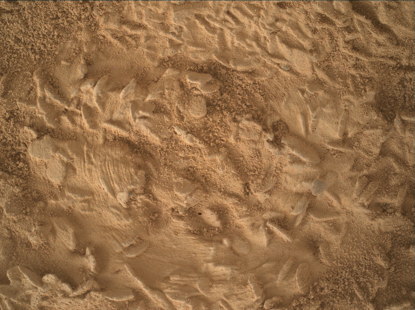
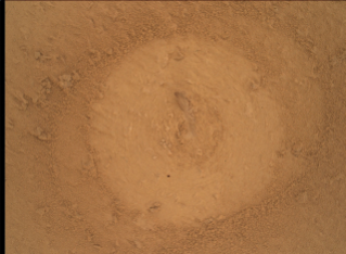
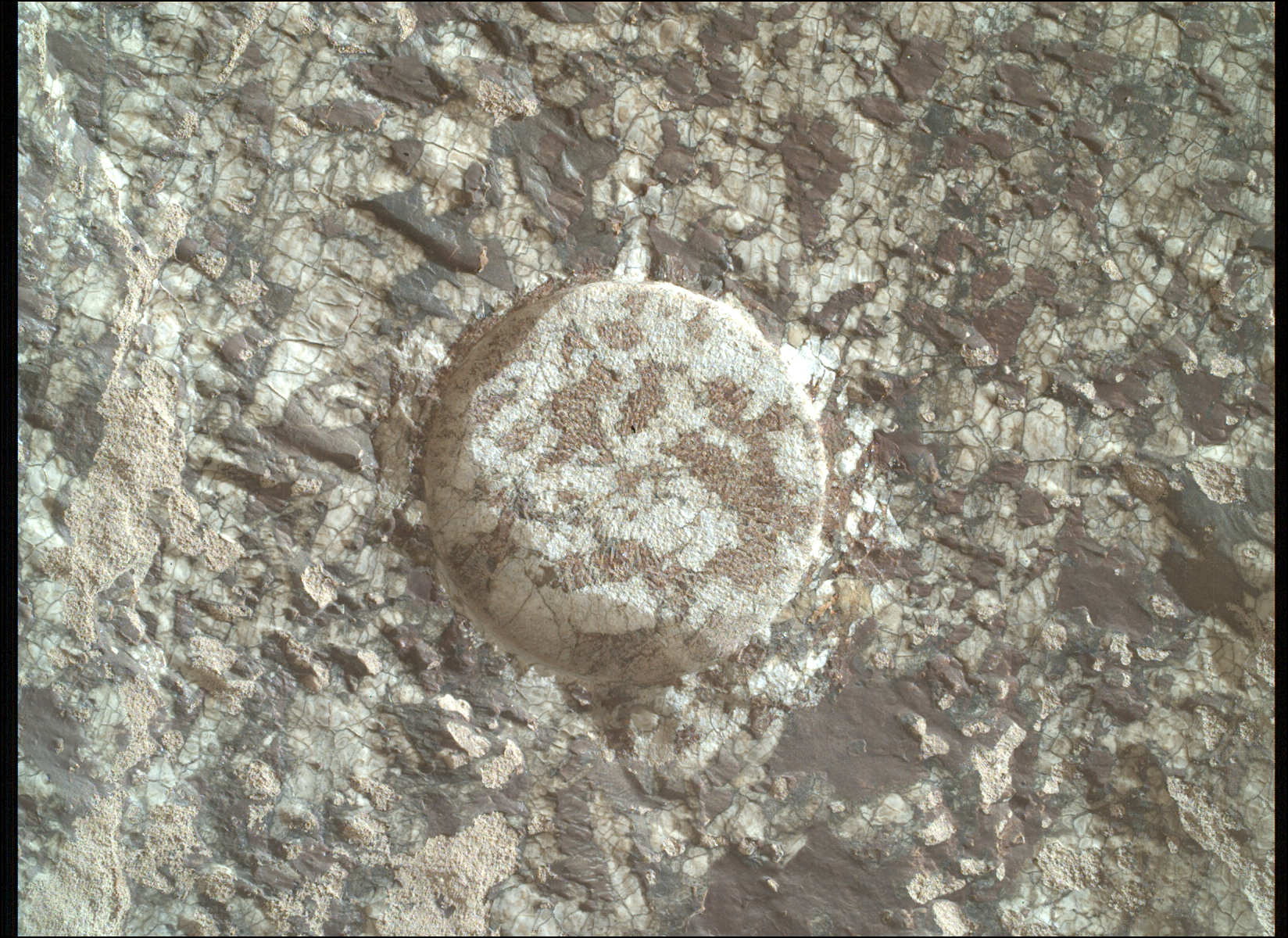
A close-up, overhead view of the Martian surface taken by the Curiosity rover. The image focuses on fine, granular, orange-brown sand that has been heavily disturbed. It features repeating curved ridges and compressed flat areas, likely tracks left by the rover's wheels. Sunlight casts tiny shadows across the textured dirt, emphasizing the depth of the deep imprints and the fine grains of the soil.
NASA’s Mars rover Curiosity acquired this close-up image using its Mars Hand Lens Imager (MAHLI), showing the abundance of roughly disc-shaped potential crystal forms on our next drill target, informally named “Nazca.” The scratches made by the DRT brush are also visible in this image. MAHLI, located on the turret at the end of the rover’s robotic arm, uses an onboard focusing process to make a composite of images of the same target acquired at different focus positions, to bring multiple features into focus in a single image. Curiosity composed the image on Oct. 18, 2026, Sol 5048 (Martian day 5,048 of the Mars Science Laboratory Mission), at 12:19:51 UTC.
NASA/JPL-Caltech/MSSS

Written by Lucy Lim, Planetary Scientist at NASA’s Goddard Space Flight Center

Earth planning date: Friday, Oct. 16, 2026

Following the Basque Lakes drill campaign, Curiosity has returned to a spot just a few meters away from the “Chiu Chiu” block to conduct our next drill campaign. “Chiu Chiu” itself wasn’t a good candidate for drilling but the block just beyond it was much more promising, so it became our drive target during Monday’s planning. I was on planning Friday as Geology and Mineralogy Science Theme Lead when we received our close-up views of the neighbor block from the post-drive imaging and our team was happy to see that it was jam-packed with the “disc- and needle-” shaped lumps, just like “Chiu Chiu.” We quickly gave the science go-ahead to proceed with preparations for drilling at the newly named “Nazca” site.

One major hypothesis about how the “discs and needles” texture formed is that the characteristic shapes were originally created during the growth of crystals, or “crystal forms.” Minerals will tend to grow into specific shapes depending on their microscopic crystal structure, similar to the salt crystals that you can grow in your kitchen as a home science project. (Maybe you have grown one of those for a science class in school!) The relatively large sizes of the crystal forms at “Nazca” and “Chiu Chiu” are providing clues about the temperature at the time when they grew and the availability of salts and fluids. However, we can’t necessarily assume that the modern-day composition represents the original mineral because sometimes mineral crystals are replaced by other minerals some time after original crystallization. The new minerals are then known as “pseudomorphs” because they have the same shape as the first minerals but not the same composition or molecular structure. 

As we prepared for the drill preload test, we also planned several special observations aimed at highly detailed characterization of the crystal forms. MAHLI will execute a Quantitative Relief Model (“QRM”) observation consisting of five overlapping images at slightly different geometries. The combination of these will enable a detailed three-dimensional relief model to be constructed. In addition, MAHLI will also add extra frames to its highest-resolution imaging by doubling the number of focus mechanism steps. Together, these observations will increase the resolution of the 3D models we will have of the crystal forms.

Meanwhile, the ChemCam LIBS will conduct a “depth profile” experiment to obtain compositional information from slightly deeper layers within a nearby crystal-form-rich target, “Toucan”. Normally the 150 LIBS laser shots from each sol’s observation are spaced out over a five-point raster at 30 shots per point, but this time we are concentrating all 150 laser shots on the same spot on the rock. Since each laser shot vaporizes a very small amount of the rock to form a plasma, the 150-shot profile should penetrate approximately five times deeper than a normal 30-shot point observation. We will thus be able to observe the composition deeper inside the exposed crystal form and see whether it’s different from the surface-level composition. There are several reasons this could be the case including exposure of the surface to the modern Martian environment and also the circumstances in which the crystal form developed originally, so it’s an experiment worth pursuing.

The LIBS, DRT and APXS will also be applied to the “Nazca” spot before the preload test to characterize its surface composition as thoroughly as possible before drilling. The third LIBS of the plan will go to “Condor,” a nearby block in which a finely layered texture is exposed.

We also continued to observe the modern Martian environment as twilight cloud season begins. In this plan we included some nighttime imaging of the larger and brighter of Mars’ two satellites, Phobos. Capturing images of Phobos and the nearby sky when Phobos is full can show sunlight reflecting off the moon and scattering in the Martian atmosphere, providing a good way to estimate the particle sizes in the Martian clouds. We can do similar measurements sometimes with solar observations, but the Phobos data allow us to measure cloud particle sizes later in the night. We expect to be measuring high-altitude carbon dioxide (CO2) clouds in this observation.
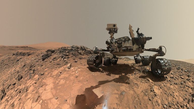
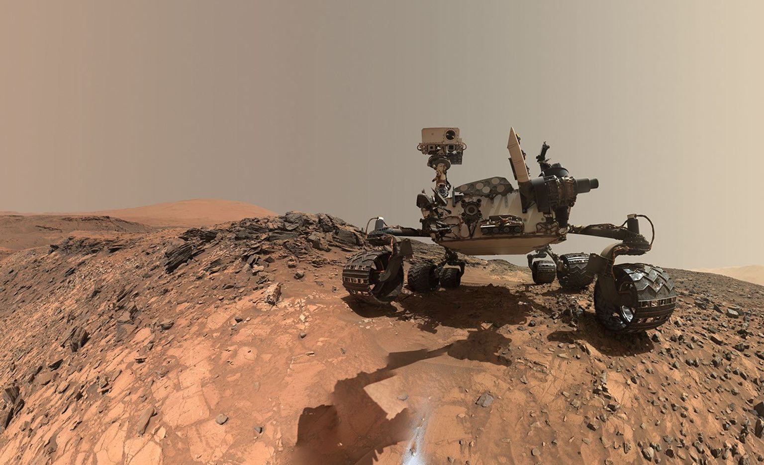
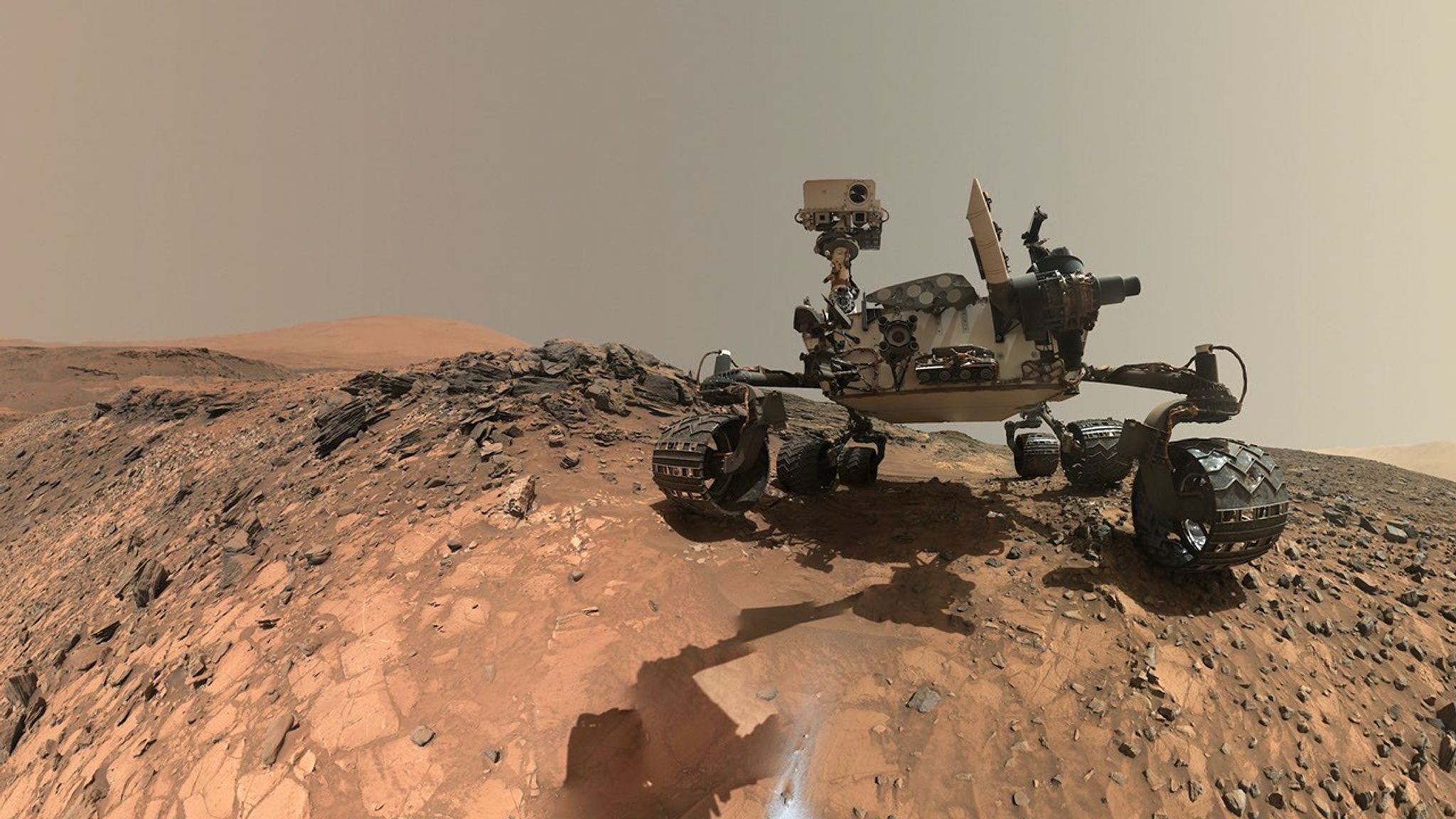
A rover sits on the hilly, orange Martian surface beneath a flat grey sky, surrounded by chunks of rock.
NASA’s Curiosity rover at the base of Mount Sharp
NASA/JPL-Caltech/MSSS

Share

Details

Last Updated
Oct 28, 2026

Related Terms

Tracks Along the Longest Drive on Another World

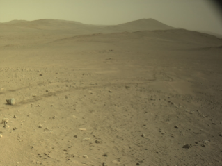
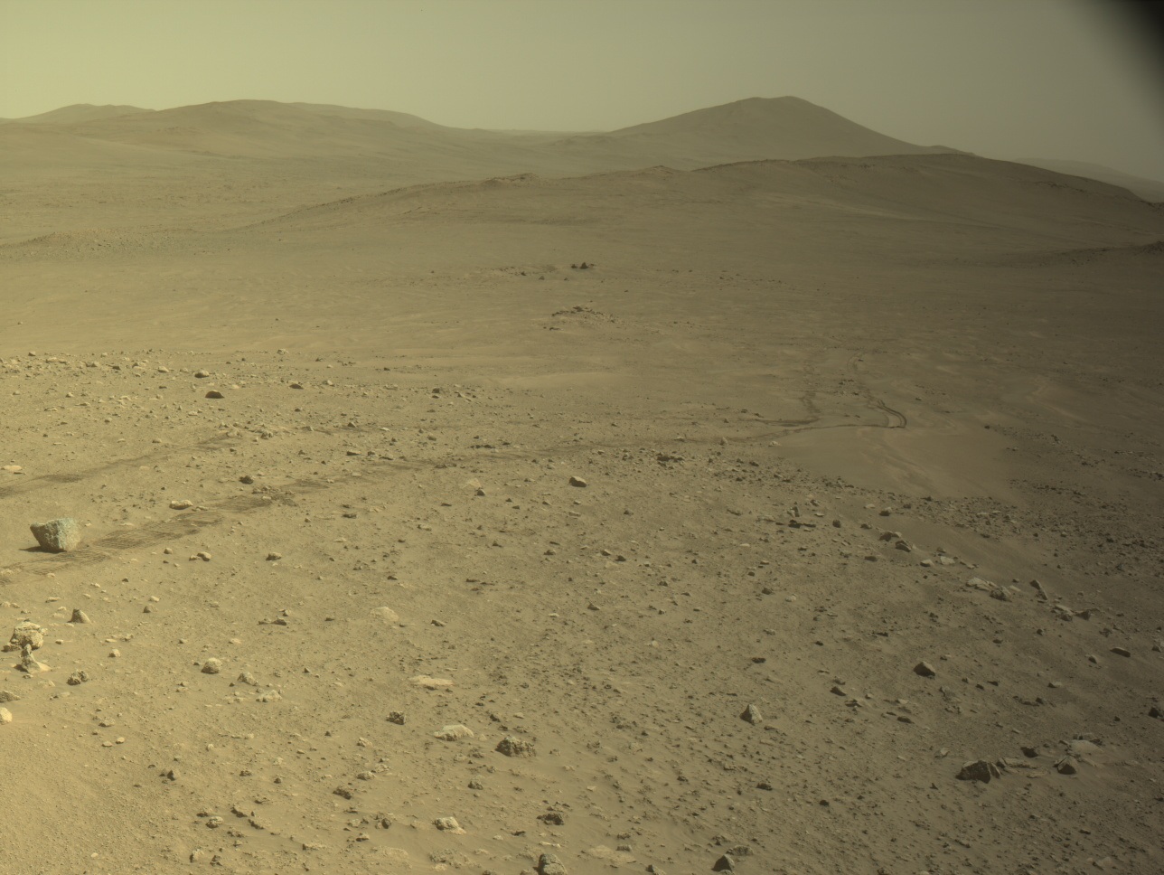
A wide view of the Martian surface taken by the Perseverance rover. The foreground features an arid, tan-colored terrain scattered with rocks and pebbles of varying sizes. Faint, parallel rover tracks curve through the dirt from the middle-left towards a shallow sandy depression in the midground. A distinct, slightly larger rock sits near the tracks on the far left. The background consists of smooth, gently rolling hills and distant ridges that fade into a hazy, pale yellow-brown sky.
This image, taken by Perseverance on Mars, shows wheel tracks from the drive that broke the record for the farthest distance driven on another celestial body. The image was acquired with its Left Navigation Camera on Oct. 11, 2026 (Sol 2006) at a local mean solar time of 14:40:39.
NASA/JPL-Caltech

Written by Vandi Verma, Chief Engineer for Robotic Operations at NASA’s Jet Propulsion Laboratory

Oct. 12, 2026

Since the last blog update, Perseverance has achieved a major milestone on Mars. On Sol 2006 (Oct. 11, 2026), its odometer reached 45.22 kilometers (28.10 miles), setting a new record for the farthest distance driven on another celestial body. Its engineering twin here on Earth even received a plaque from Guinness World Records celebrating the achievement. 

Two months ago, on Sol 1947, the odometer sat about 200 meters away from the milestone, a distance easily achievable with a single drive using Autonomous Navigation (AutoNav). However, the rover found itself in a very scientifically interesting area and spent time executing short drives to perform rock abrasions and proximity science on ancient rock outcrops. When Perseverance was finally ready to move on to a new site, it sailed past the record. 

On its way to the drive record, Perseverance has navigated challenging terrain while also pioneering new ways to drive across the Martian surface. Perseverance’s various encounters with dense boulder fields and steep slopes have pushed the team to re-evaluate driving guidelines so the rover is better prepared to handle tough terrain. After running thousands of simulations, the team raised the rover’s tilt limit to 24 degrees and reduced the clearance required under the rover’s belly pan to 20 centimeters (about 7.9 inches). The team also updated the rover’s braking software to avoid rock hazards, nearly doubled steer motor current limits, updated flight software with “dynamic slip tables” to model expected slip, and used cross-slope driving to better anchor wheels on exposed bedrock.  

One of the most exciting updates the team has made is an autonomous drive capability called onboard Global Localization (GBLC). GBLC repurposes the high-speed commercial processor inside the Ingenuity Helicopter Base Station to compare ground and orbital imagery to autonomously locate the rover in global coordinates at the end of a drive (as though we had GPS on a world without it), enabling Perseverance to drive longer distances without human intervention. Unlike Perseverance’s main flight computer, this coprocessor is not hardened against the punishing radiation environment of the Martian surface, where a thin atmosphere and the lack of a global magnetosphere leave little shielding. This radiation can induce “transient bit flips” in memory the software needs to function, and the team developed an effective software-based approach to radiation hardening. Looking forward to the greater demands of longer drives and to planning more activity with fewer resources, the team is also exploring the use of generative SI to help efficiently propose solutions to steer AutoNav along the many legs of a strategic path.  

The team is using hard-won lessons from 45 kilometers (more than 28 miles) of driving to reinvent how the rover drives across the Martian surface. As Perseverance climbs higher along the crater rim, the next leap in autonomous exploration on Mars is just getting started. 

Curiosity Blog, Sols 5036-5042: Watching the Clouds Go By

3 min read

Curiosity Blog, Sols 5036-5042: Watching the Clouds Go By

A grainy, black-and-white image of the sky above Mars, captured by the Curiosity rover. The upper right portion of the image is brightly illuminated, highlighting delicate, wispy, cirrus-like cloud structures. The brightness diffuses outward, transitioning into a dark, textured gradient toward the bottom and left edges of the frame.
NASA’s Mars rover Curiosity acquired this image, a frame from one of this week’s zenith movies, looking directly overhead shortly before sunset on Oct. 7, 2026 — Sol 5037, or Martian day 5,037 of the Mars Science Laboratory mission — at 19:44:19 UTC. Curiosity used its Right Navigation Camera, and you can see the high, wispy clouds that are characteristic of the sky above Gale Crater at this time of year.
NASA/JPL-Caltech

Written by Alex Innanen, Atmospheric Scientist at York University

Earth planning date: Friday, Oct. 9, 2026

Happy New Mars Year! We mark the start of a new year on Mars at the beginning of the northern hemisphere spring, or the vernal equinox. We then keep track of the seasons by counting degrees of solar longitude — each season is 90 degrees as Mars completes the whole 360 degrees of its orbit. The start of Mars year 39 at a solar longitude of 0 degrees (or Ls=0°, pronounced “ell-sub-ess-zero” if you want to sound like a Martian) came at the end of September on Earth. The new year also means it’s now autumn in Gale Crater, just south of the equator.

As Michelle talked about last week, we rang in the Martian new year with our drill campaign at “Basque Lakes.” This week was dedicated to wrapping up drill activities before we drive away on the weekend. After the team got a chance to see the results of last week’s lab activities, the SAM team decided on an additional GCMS (Gas Chromatograph/Mass Spectrometry) experiment. While GCMS tends to be an energy-intensive activity, we had four whole sols in Monday’s plan to play with, so we still had room for a slew of remote-sensing activities from Mastcam and ChemCam and contact science of the drill tailings — the bits of rock and minerals that are left over from our drill sample. This weekend’s plan gives us a couple more sols to wrap up drill activities at Basque Lakes and collect any last contact- or remote-science targets we want here before we begin a drive back toward the neat crystal forms we saw in the “Chiu Chiu” region.

While all this is happening, the atmosphere around us continues to go through its seasonal changes. Autumn means the return of high-altitude twilight clouds, which the low sun angle at sunset illuminates beautifully. While twilight cloud activity will pick up as the autumn progresses, our late afternoon cloud movies on Wednesday of this week already caught our first high-altitude clouds of the season, as you can see at the top of this post. Most of the clouds we tend to see at Gale Crater are suboptical, or too thin to be seen with either human eyes or with Curiosity’s robotic “eyes,” but these twilight clouds are bright enough that we can see them in the raw Navcam images. I’m looking forward to another Martian autumn of watching all these different clouds go by.

A rover sits on the hilly, orange Martian surface beneath a flat grey sky, surrounded by chunks of rock.
NASA’s Curiosity rover at the base of Mount Sharp
NASA/JPL-Caltech/MSSS

Share

Details

Last Updated
Oct 19, 2026

Related Terms

A Journey to the Depths of Ancient Mars?

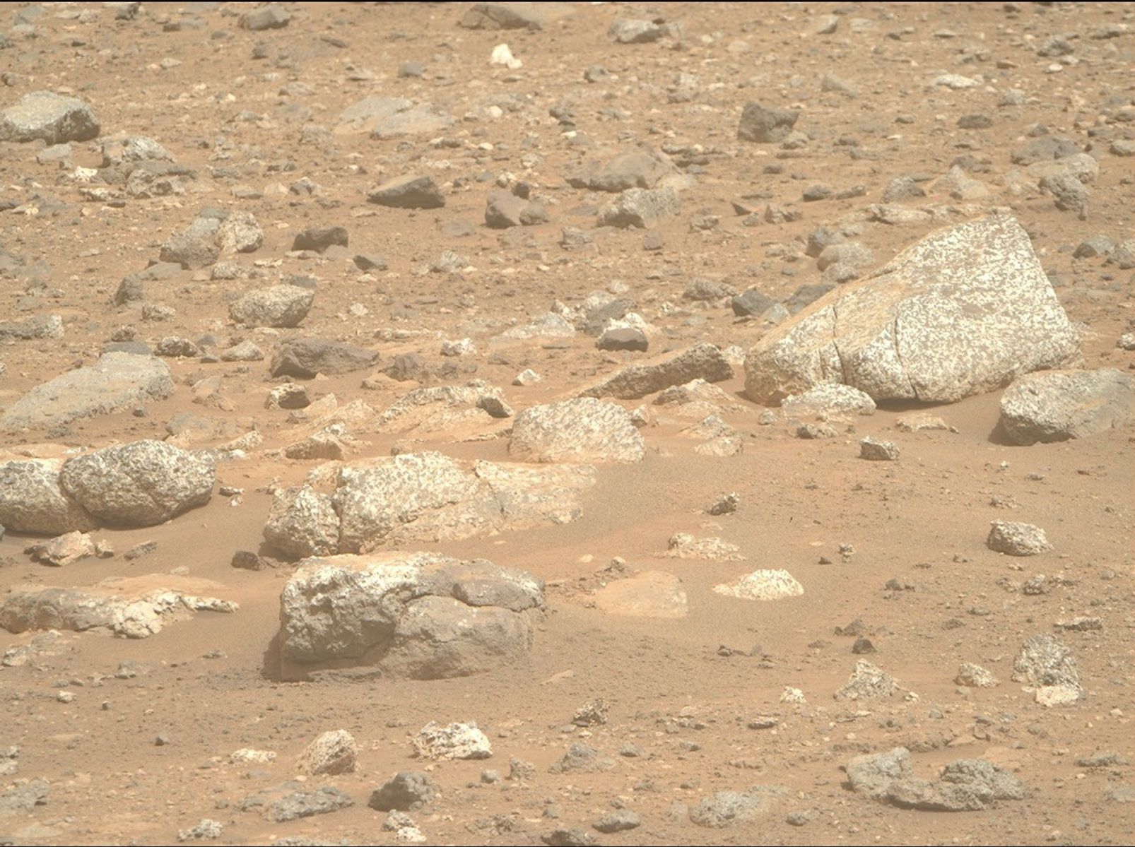
A view of the Martian terrain showing reddish-brown, dusty ground littered with rocks of various sizes. In the foreground and midground, there is a cluster of large, angular rocks characterized by a highly textured, speckled pattern of white and dark grey. The surrounding surface is covered in smaller, rough pebbles and stones partially embedded in the sand. No sky or horizon is visible.
NASA’s Perseverance rover acquired this image of some light-toned boulders scattered across a hillside of a region called “Lac de Charmes,” beyond the western rim of Jezero crater. Perseverance captured the image using its Right Mastcam-Z camera on Aug. 30, 2026 (Sol 1965, or Martian day 1,965 of the Mars 2020 mission) at the local mean solar time of 11:42:55.
NASA/JPL-Caltech/ASU

Written by Alex Jones, Ph.D. candidate at Imperial College London

Sept. 29, 2026

After spending the last six months exploring “Lac de Charmes,” a region of ancient rock beyond Jezero crater’s western rim, Perseverance has stumbled upon a vast field of light-toned rocks peppering the Martian surface. 

Light-colored rocks are a strange sight on Mars, a planet dominated by dark-colored basaltic rocks. This many light-colored rocks in one place piqued the Science Team’s interest… what are they? How did they get here? 

To answer the first question, Perseverance has been investigating the composition and textures of these rocks. Data so far indicates that many of them are igneous rocks called gabbro, which are dominated by minerals rich in iron and magnesium. Such rocks typically form by slow cooling and crystallization of magma deep in the crust. 

So how did these deep fragments of Mars find their way to the surface? 

Perseverance has spent the last week trying to answer this question by investigating a patch of possible bedrock poking out between the light-toned boulders and loose regolith. 

Initial images suggest that the rock is made up of light- and dark-colored, angular fragments of rock, forming what geologists call a breccia. One possibility the team is investigating is that the light-toned boulders scattered across the hillside have eroded out of this breccia. 

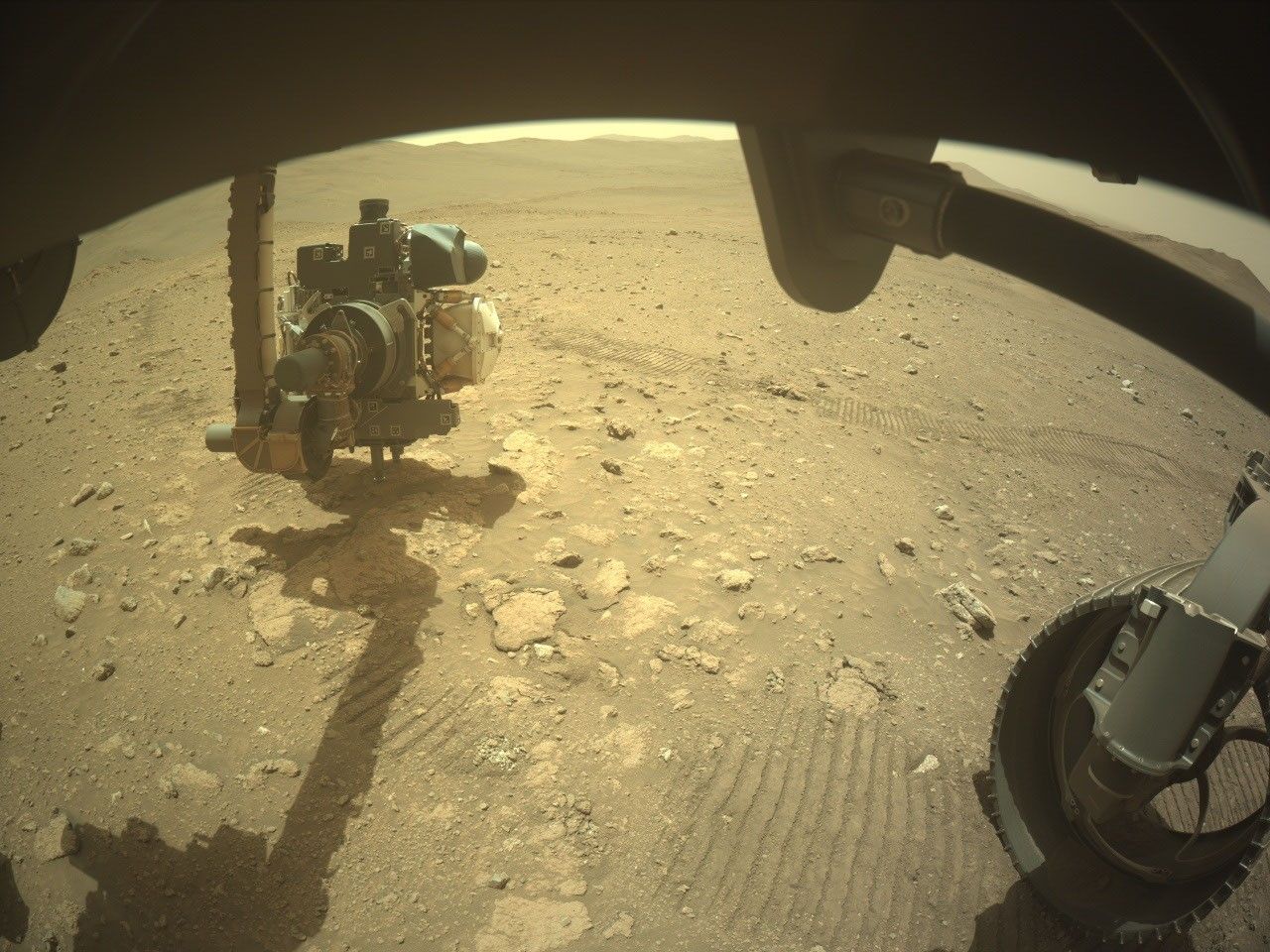
A wide-angle, slightly distorted view from beneath the Perseverance rover on Mars. Parts of the rover's dark chassis frame the top edge. On the bottom right, a section of one of its treaded wheels rests on the dirt. On the left, the rover's robotic arm, featuring a complex instrument turret at its end, is extended toward the ground. The arm casts a long, distinct shadow over the reddish-brown, rocky sand. Parallel rover tracks are pressed into the soil, leading away toward a relatively flat, barren landscape that ends at a horizon of distant, low hills under a pale sky.
Perseverance deploys its arm mounted instruments to investigate a possible breccia outcrop at “Idubi.” The rover acquired this image of the area in front of it using its onboard Front Right Hazard Avoidance Camera A on Sept. 27, 2026 (Sol 1992, or Martian day 1,992 of the Mars 2020 mission) at the local mean solar time of 12:03:10.
NASA/JPL-Caltech

Breccias often form through violent processes involving the fracturing and transport of rock to produce their angular shapes. Layers of breccia observed outside Jezero have previously been attributed to asteroid impacts on early Mars. Perhaps similar impacts (or the Jezero impact itself?) could be responsible for digging up these light-colored blocks.  

Only time (and of course, Perseverance), will tell. 

Curiosity Blog, Sols 5022-5028: Cashing in at Cache Creek

3 min read

Curiosity Blog, Sols 5022-5028: Cashing in at Cache Creek

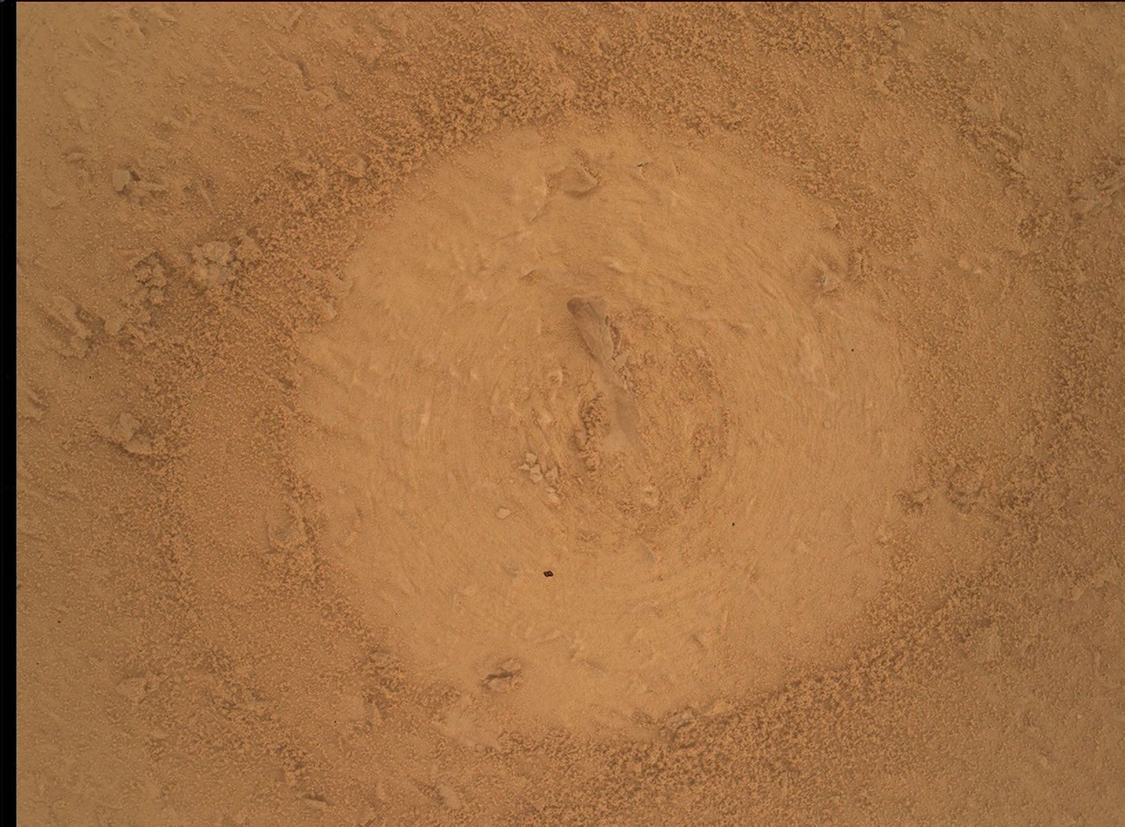
A close-up, overhead view of reddish-brown Martian soil taken by the Curiosity rover. In the center is a distinct, circular area where the top layer of rough soil has been smoothed or brushed away, leaving faint concentric ring marks. A small, elongated rock fragment is embedded in the very center of this circular patch. The brushed circle contrasts with the surrounding undisturbed surface, which is covered in loose, coarse sand and small, crumbly pebbles.
NASA’s Mars rover Curiosity acquired this image of the “Basque Lakes” drill site after the pre-load test, using its Mars Hand Lens Imager (MAHLI), a close-up camera located on the turret at the end of the rover’s robotic arm. Curiosity acquired the image on Sept. 23, 2026 — Sol 5023, or Martian day 5,023 of the Mars Science Laboratory Mission — at 03:56:10 UTC.
NASA/JPL-Caltech/MSSS

Written by Lucy Thompson, Senior Research Scientist, University of New Brunswick, Canada

Earth planning date: Friday, Sept. 25, 2026

Before we landed, the area of Gale crater that we planned to explore was divided up into rectangular parcels with designated names. The names were chosen after small towns associated with significant geological features. Our selected targets (mesas, bedrock, soil, boulders, etc.) within those quads were then given unofficial names based on the theme of the quad. See the link here for more details on naming conventions on Mars. Curiosity has long since climbed above the quads that were selected before landing, and before her 14-year, 38-kilometer (24.6-mile) trek, which included more than 1 kilometer (0.6 miles) of elevation gain. 

We recently entered the new Cache Creek quad, named after an area of geological diversity in British Columbia, Canada. The area in Canada includes exposures of oceanic crust, marine sediments, volcanic rocks, and glacial deposits, as well as being home to lakes with unusual chemistry that may be analogous to lakes that once existed on Mars. It also lies at the southern end of the 1860s Gold Rush Trail, where miners and prospectors flocked to this part of British Columbia in search of riches. This week we successfully drilled into our 48th rock target in Gale crater (“Basque Lakes”), from the Cache Creek quad. While we may not literally strike gold, we are all eagerly anticipating the outcome of the CheMin X-ray diffraction analysis of our drilled sample that will take place in this weekend plan. What gold mine of minerals will the sample contain? What can they tell us about the depositional and alteration history of this rock exposure — might there be similar minerals present as those associated with some of the lakes in the Cache Creek area of British Columbia?

As an APXS uplink lead and strategic planner this week I helped to plan the triage contact science on the potential Basque Lakes drill target and communicate the results to the rest of the team. We placed APXS in contact with the rock target to measure its chemistry, and the MAHLI camera to within 1 centimeter (about 0.4 inches) to examine in detail the textures. ChemCam also fired its laser at the Basque Lakes drill target to further characterize composition. MAHLI also imaged the target after the engineers checked the stability of the rock with a pre-load test. The results from all these activities helped to determine whether to proceed with drilling.

Despite significant power constraints associated with drilling and the accompanying analyses, as well as an aging rover, we were also able to plan additional activities. Mastcam imaged the surrounding terrain to provide context for our new drill sample. ChemCam was able to analyze the chemistry of another nearby bedrock target, “Peace River,” and use its imaging and passive spectroscopic capabilities to look at the new drill hole and surrounding tailings. ChemCam remote imaging was also used to examine an interesting-looking deposit of jumbled blocks at the base of a nearby butte, “Cordillera.” 

We also utilized Navcam and Mastcam imaging in the continued monitoring of environmental and atmospheric conditions in Gale crater. 

Analysis of the Basque Lakes drill sample should continue next week with delivery of material to SAM, which will reveal more nuggets of information regarding the history of this particular rock sample. Curiosity will likely be at this location for another week, before we dump the sample and drive away to continue our exploration of Mount Sharp and Gale crater.

A rover sits on the hilly, orange Martian surface beneath a flat grey sky, surrounded by chunks of rock.
NASA’s Curiosity rover at the base of Mount Sharp
NASA/JPL-Caltech/MSSS

Share

Details

Last Updated
Oct 05, 2026

Related Terms

Curiosity Blog, Sols 5016–5021: Fantastic Minerals and How To Detect Them

3 min read

Curiosity Blog, Sols 5016–5021: Fantastic Minerals and How To Detect Them

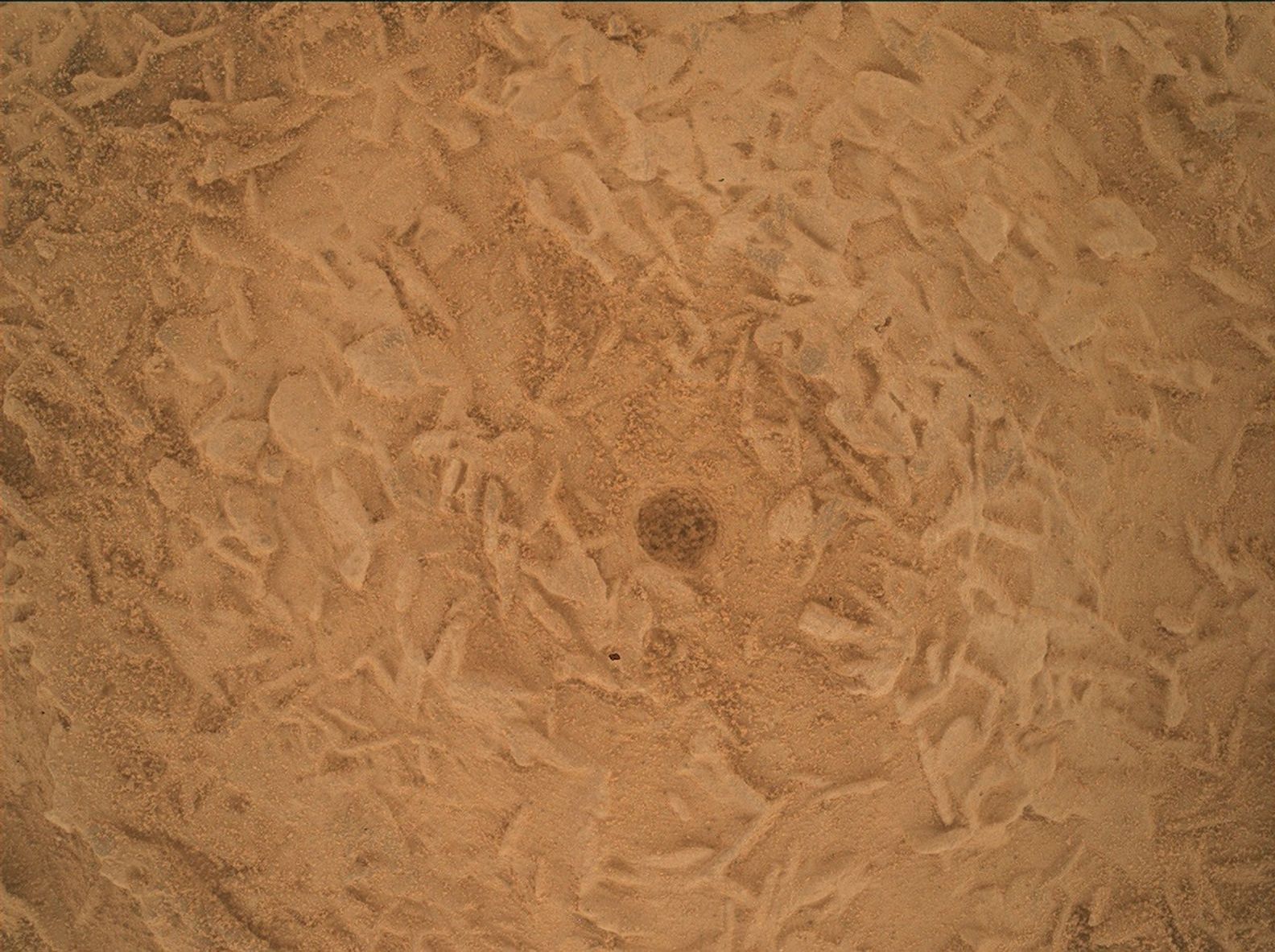
A close-up view of a dusty, reddish-brown Martian rock surface taken by the Curiosity rover. The surface is highly textured, covered with a complex network of small, raised, intersecting ridges that resemble tiny blades or crystals buried under a fine layer of sand. Right in the center of the frame is a small, distinct, dark circular hole.
NASA’s Mars rover Curiosity generated this close-up image of a brushed spot on bedrock (informally named “Salar de Vacas”), showing a jumble of roughly disc-shaped features as well as a divot generated by the brushing from the rover’s Dust Removal Tool (DRT). The features are about 3-4 millimeters across (about 0.12-0.16 inches) and about 1 millimeter thick (about 0.04 inches). Curiosity created the image using its Mars Hand Lens Imager (MAHLI), a close-up camera located on the turret at the end of the rover’s robotic arm, and an onboard focusing process that merges multiple images of the same target at different focus positions, creating a composite that brings as many features into focus as possible. Curiosity performed the focus merge on Sept. 16, 2026 — Sol 5016, or Martian day 5,016 of the Mars Science Laboratory Mission — at 02:14:02 UTC.
NASA/JPL-Caltech/MSSS

Written by Lucy Lim, Planetary Scientist at NASA Goddard Space Flight Center

Earth planning date: Friday, Sept. 18, 2026

Curiosity surprised us at the beginning of the week with a change in rock texture — instead of the finely layered bedrock blocks we’ve been seeing in our recent sulfate unit workspaces, suddenly we were looking at blocks covered (and likely filled) with a jumble of small disc-shaped lumps. We’ve seen somewhat similar features before much earlier in the mission — for example, close to the Pahrump Hills back in the Murray mudstones, and they’re sometimes seen in Earth rocks as well, especially in settings in which minerals were precipitating from an evaporating fluid. The disc-like shapes could be created by the growth habits of a specific crystalline mineral that is known to grow into similar shapes, or they could be bits of a harder rock layer that broke up and collected here. We planned Mastcam and MAHLI imaging for more morphological detail on the jumbled disc blocks (“Yungay,” “Chiu Chiu”) as well as LIBS (“Puya Raimondii,” “Liolaemus Tacnae,” “Pisqu Warkatana”) and APXS (“Salar de Vacas”) to investigate their composition. 

Ongoing long-distance imaging projects were furthered by ChemCam long-distance remote imager (RMI) and Mastcam mosaics of the buttes on either side of Valle Grande. These “cutaway”-view images of the strata above the rover will help us map sedimentary structures in these upcoming units and understand how these rocks formed and eroded. Views of more recent erosional deposits will also help us to understand the formation of Valle Grande itself.

In order to identify minerals, Curiosity needs data from the CheMin X-ray diffraction instrument, which means a drill campaign. We’ve driven over a kilometer since our last drill site at Campo Marte, and this will be our first drill above the erosional supersurface. The Wednesday plan’s drive brought us up next to a promising drill workspace a little beyond where we saw the disc-shaped features discussed above (imaged as “Torres del Paine” by Mastcam) and Friday’s planning included site characterization with the instruments on Curiosity’s arm (“Alberta Wild Rose,” “Moonraker Mountain”), ChemCam LIBS (“Osoyoos”), and Mastcam (“Trincomali Channel,” “Yellow Lady’s Slipper”). The team also selected a specific drill target and planned a very short drive to bring it in range of the arm — first for contact science and then, if all goes well, for the preload test and drill.

I’ll be back on planning on Monday as Geology and Mineralogy Science Theme Lead for Drill Sol 1 (Triage Contact Science) and we’ll see how things go from there!

A rover sits on the hilly, orange Martian surface beneath a flat grey sky, surrounded by chunks of rock.
NASA’s Curiosity rover at the base of Mount Sharp
NASA/JPL-Caltech/MSSS

Share

Details

Last Updated
Sep 30, 2026

Related Terms

Mars Has Its Charmes

A close-up view of a rough, heavily cracked Martian rock surface. In the center is a perfectly circular, shallow, ground-down patch — created by the rover's abrasion tool — that exposes the freshly scraped rock underneath. The exposed interior within the circle is lighter in color with a speckled, mottled texture, contrasting with the darker, rougher, and dustier exterior of the surrounding rock.
NASA’s Mars Perseverance rover acquired this image using its SHERLOC WATSON camera, located on the turret at the end of the rover’s robotic arm. Perseverance acquired this image on Sept. 1, 2026 (Sol 1967, or Martian day 1,967 of the Mars 2020 mission) at the local mean solar time of 16:18:01.
NASA/JPL-Caltech

Written by Athanasios (Thanos) Klidaras, Ph.D. candidate at Purdue University 

Sept. 21, 2026

After a long hiatus, the Perseverance rover updates page is back. A lot has happened on Mars in the meantime, and with regular updates now resuming, there is plenty to catch up on — Perseverance has been busy. The rover has spent 2026 exploring the “Lac de Charmes” area, an area of valleys and ridges west of the Jezero crater rim that represent a “wild west frontier” for the mission. The rocks in this area are among the oldest Perseverance has encountered. They formed when Mars was still a young planet bombarded by asteroid impacts, long before the sedimentary rocks inside Jezero crater formed in rivers and lakes. They therefore could teach us much about the earliest era of Martian history — and, more broadly, how rocky planets evolved during the tumultuous early history of our solar system. 

The science team decided to thoroughly explore this ancient and intriguing terrain first, before deciding which rocks to sample. If you take a look at the rover’s location map, you’ll see that Perseverance has followed a looping path winding between interesting outcrops, helping scientists build up an understanding of how “Lac de Charmes” formed. In this time, Perseverance has created a total of 13 abrasion patches on rocks that caught the team’s attention, providing a feast of scientific data. So far, investigations suggest that many appear to have formed from cooled lava or magma (igneous rocks), as well as others that formed in the aftermath of a violent impact (impactite rocks) — and some that show evidence for both processes. Exploration has been boosted by a new algorithm that makes clever use of a processor originally used to communicate with the Ingenuity helicopter to achieve longer and more accurate drives. 

Perseverance’s exploration of the “Lac de Charmes” region is now nearing its end, but the discoveries certainly haven’t stopped. Recently, the science team sent the rover towards an area nicknamed “Idubi,” where hundreds of light-toned boulders were spotted from a distance. “Idubi” has proven to be a scientific bonanza, where rocks of varying texture and composition are concentrated. When Perseverance investigated one of these light-toned boulders, an abrasion patch fittingly named “Badger Peak” revealed a spectacular light-and-dark texture (shown in the image above) unlike any the rover has seen before. An attempt to sample this boulder was unsuccessful due to its high hardness, so the team is now searching elsewhere for a similar rock to sample.  In the meantime, Perseverance has stopped to investigate an interesting outcrop nearby named “Gardenia,” which could be a breccia — a rock that is itself comprised of fragments of many older rocks. This week, the rover will attempt an abrasion to give the science team a detailed look. Even after months of exploring Lac de Charmes, the team continues to be surprised, and with Perseverance preparing to move onward once again, there should be no shortage of new stories to share here. 

❌