Reading view

There are new articles available, click to refresh the page.

Curiosity Blog, Sols 4954–4960: Celebrating Our Rover Engineers Past and Present

3 min read

Curiosity Blog, Sols 4954–4960: Celebrating Our Rover Engineers Past and Present

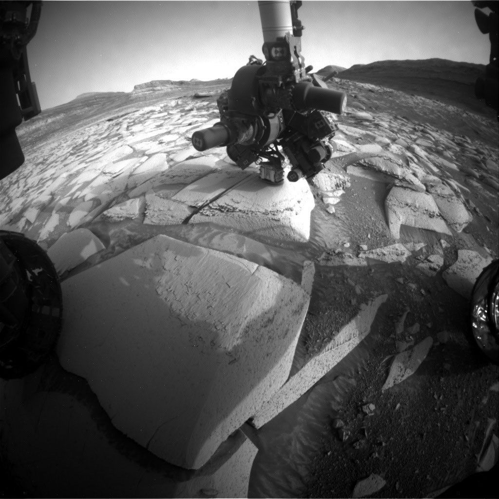
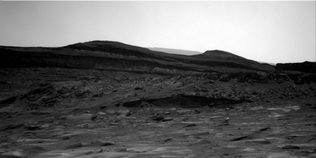
A black and white landscape photograph taken on Mars by the Curiosity rover. In the foreground, scattered rocks and uneven sandy terrain lead up to a rocky outcropping with distinct horizontal geological layers. Behind this ridge, dark, smooth-topped hills rise against a bright, featureless sky.
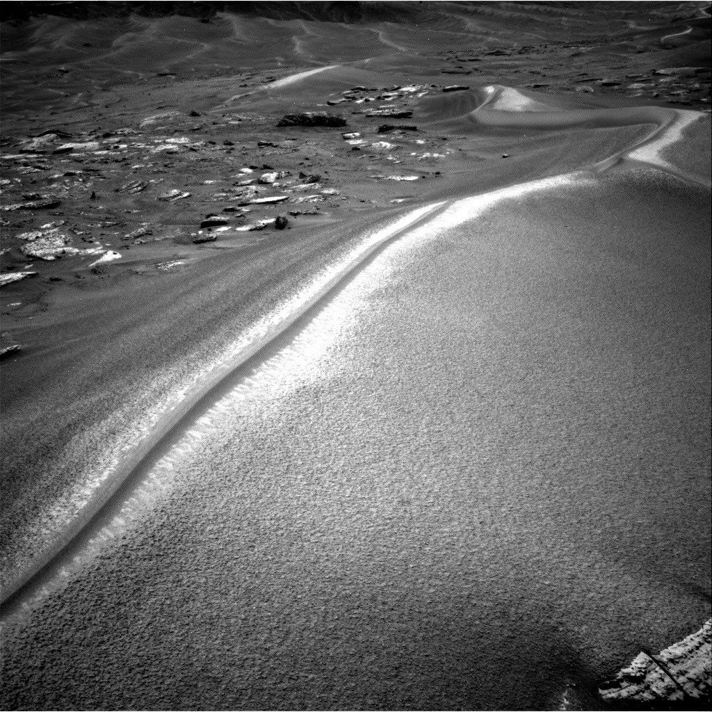
In this image acquired by NASA’s Mars rover Curiosity, the relatively light-toned bedrock in the foreground gives way to darker-toned rocks in the middle of the image, along what could be an erosional surface. Curiosity acquired the image using its Right Navigation Camera on July 15, 2026 — Sol 4955, or Martian day 4,955 of the Mars Science Laboratory mission — at 05:51:59 UTC.
NASA/JPL-Caltech

Written by Lucy Thompson, Senior Research Scientist, University of New Brunswick, Canada

Earth planning date: Friday, July 27, 2026

As an APXS uplink lead and strategic planner, I have the privilege of working with the rover engineers most days that I am on operations. The APXS instrument measures the chemistry of rocks, unconsolidated materials and the atmosphere, and is situated on the end of Curiosity’s robotic arm. This means that any target of interest that we wish to analyze has to be safe to deploy the arm, APXS, and MAHLI (the closeup imager) to. We therefore rely on the rover engineers for their assessment and to sequence the arm moves to place us safely on the targets. Recently, our workspaces have been dusty with varied relief, but the rover engineers have successfully found areas that they have been able to brush and deploy APXS and MAHLI. This week was no exception, despite some of our workspaces appearing less than ideal upon initial observation. The team managed to find rock targets of interest (x5), which the rover engineers were able to safely place the arm on and brush so that we could analyze them with APXS and MAHLI. This ensures that we acquire high-quality compositional data and images as we continue our ascent of Mount Sharp, through rock layers of varying tone and texture, tracking potential changes in chemistry, and the depositional and alteration environment. 

The rover engineers are also responsible for safely driving Curiosity to the areas of interest identified by the science team. They must assess the terrain for potential hazards such as large resistant blocks that could damage the rover wheels, sand/soil patches where we could get stuck, and high slopes that the rover could slip on. Despite unexpected damage to the wheels early in the mission and getting a little bogged down in some soil/sand just as we started to climb Mount Sharp, the engineers have successfully navigated us safely along more than 23 miles (37 kilometers) of drive distance and more than 4,400 feet (about 1.35 kilometers) of elevation gain. We recently requested to drive to specific locations in order to image what the team thinks could be an erosional surface within the Mg-sulfate/carbonate-bearing unit (see the image accompanying this post). Of course, the engineers were able to accommodate our desires, with the first stop crossed off in Monday’s plan, and the drive that is being planned this weekend taking us toward the next stop.

The rover engineers also ensure that our drilling activities execute safely and successfully, and are responsible for sequencing the arm motion required to deliver the drilled samples to our internal CheMin and SAM instruments. This required completely reconfiguring how we drill after a motor failed back in 2016, with extensive behind-the-scenes work at JPL for nearly a year and a half before we resumed. Curiosity has since drilled more than 20 rock targets.

So, thanks to the rover engineers and all the engineers and scientists on Curiosity’s team, we have had another full week of activities at Gale crater. We continue to track the chemistry, textures, tone and sedimentary structures of the sulfate/carbonate unit as we climb Mount Sharp and get ever closer to the Yardang unit with APXS, ChemCam, MAHLI and Mastcam. Curiosity continues to also monitor the local environment within Gale and the atmosphere in general. 

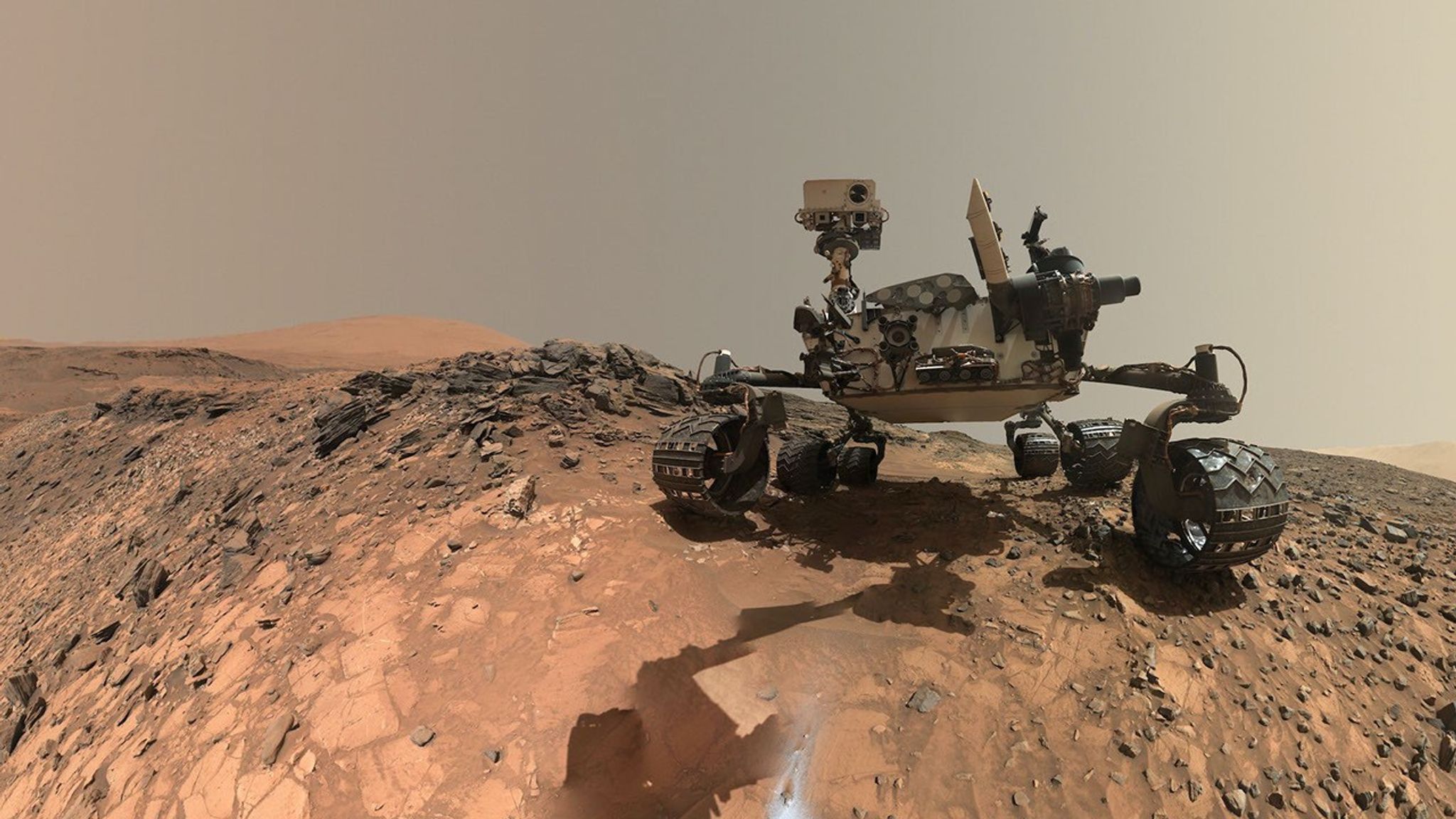
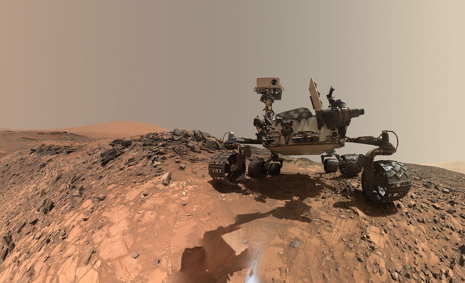
A rover sits on the hilly, orange Martian surface beneath a flat grey sky, surrounded by chunks of rock.
NASA’s Curiosity rover at the base of Mount Sharp
NASA/JPL-Caltech/MSSS

Share

Details

Last Updated
Jul 23, 2026

Related Terms

Curiosity Blog, Sols 4947-4953: Gale Crater Then and Now

3 min read

Curiosity Blog, Sols 4947-4953: Gale Crater Then and Now

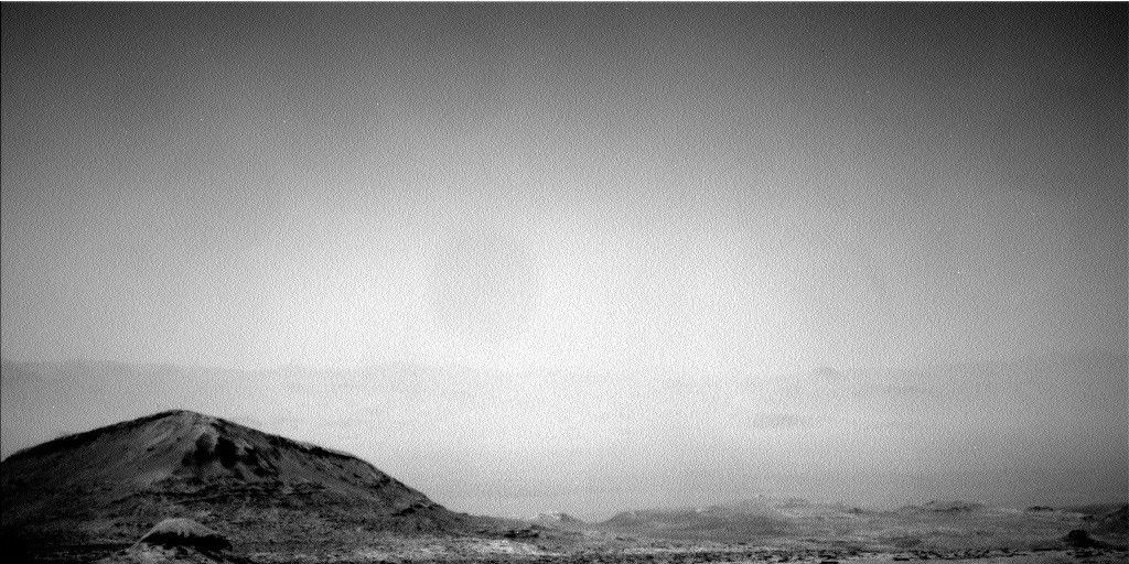
A grainy, black-and-white photograph of a barren Martian landscape taken by the Curiosity rover. In the lower left foreground, a prominent, dark hill with rugged textures and sloping sides rises above the terrain. The ground to the right is rocky and uneven, stretching into the distance to the faint, hazy outline of a jagged horizon line. The upper two-thirds of the image is filled with a bright, featureless, gray and hazy sky.
NASA’s Mars rover Curiosity acquired this image looking north through the dusty air of Gale Crater toward the faint crater rim. Curiosity used its Left Navigation Camera on July 8, 2026 — Sol 4948, or Martian day 4,948 of the Mars Science Laboratory mission — at 04:57:40 UTC.
NASA/JPL-Caltech

Written by Alex Innanen, Atmospheric Scientist at York University, Toronto

Earth planning date: Friday, July 10, 2026

Curiosity had a successful long weekend and came into this week ready to explore some more. We’ve been moving fairly rapidly through different mapped “units,” or distinct geological areas of interest, visiting a different one at each of our three stops this week. The terrain all around us can give us clues about the past environment of Gale Crater, and geologists can look at the different compositions and appearances of what may look like ordinary rocks to the rest of us, to infer how it was laid down and altered by its environment in the distant past. 

All three of our stops this week included contact science with MAHLI and APXS, as well as compositional analyses with the ChemCam LIBS instrument. Mastcam and ChemCam also continued to study the broader context of this area with medium and longer-distance imaging of the buttes and other formations we see around us. Among the different layers and textures of bedrock are features that formed from some past erosion and we looked at different examples of these through the week, as well. 

While every rock Curiosity chooses to examine is special (that’s why we give them all names!), two in particular stood out this week. Monday’s and Wednesday’s workspaces both contained rocks that were darker than the ones around them, so they may have been brought in from elsewhere, or could even be meteorites. To help figure out their histories, we turned LIBS on them to look at their compositions.  

Of course we are not only interested in peering into Mars’ past — we also care about its present environment. As we approach the end of the Mars year, moving through summer in Gale Crater and looking towards autumn, the atmosphere almost seems to calm. The turn of the Mars year sees us transition from the dusty season back into the cloudy season, so we’re keeping a keen eye on both dust and clouds. This time of year is the last gasp of the dusty season, what we call the “C” storm season, when mid-size, regional dust storms can form. So we’re keeping an eye out for signs of these with both Mastcam and Navcam. Aside from our dust and cloud imaging, we —  as always — have our trusty suite of REMS instruments adding to our daily meteorological record of Gale Crater with regular measurements.

A rover sits on the hilly, orange Martian surface beneath a flat grey sky, surrounded by chunks of rock.
NASA’s Curiosity rover at the base of Mount Sharp
NASA/JPL-Caltech/MSSS

Share

Details

Last Updated
Jul 15, 2026

Related Terms

Curiosity Blog, Sols 4941-4947: (Pin)Stripes on the Fourth of July

4 min read

Curiosity Blog, Sols 4941-4947: (Pin)Stripes on the Fourth of July

A black and white photograph of the Martian surface taken by the Curiosity rover, showing an expanse of fractured, light-colored bedrock. The rocks are distinctly layered and sedimentary, broken into flat, horizontal slabs and polygonal plates. Darker sand and loose dust fill the crevices and low areas between the rocky outcrops, emphasizing the rough, textured terrain.
NASA’s Mars rover Curiosity acquired this image of the “Cerro Castillo” bedrock outcrop with target “Hornillos” at the bottom center. Curiosity used its Left Navigation Camera on July 1, 2026 — Sol 4942, or Martian day 4,942 of the Mars Science Laboratory mission — at 23:50:44 UTC.
NASA/JPL-Caltech

Written by Deborah Padgett, MSL Operations Product Ground System Task Lead at NASA’s Jet Propulsion Laboratory

Earth planning date: Thursday, July 2, 2026

Curiosity spent the week leading up to the Fourth of July holiday approaching a geologic boundary between a very smooth but somewhat sandy region and a rougher bedrock unit. 

Leaving the polygonal terrain behind, the rover arrived at the first location of the week on Sol 4939 and, on the following sol, 4940, looked for dust devils with Navcam and performed an AEGIS ChemCam laser-spectroscopy observation and Mastcam imaging of a target selected onboard the rover. Unfortunately, there were no large rocks appropriate for brushing with the DRT at this rover stop. 

On Sol 4941, the MAHLI camera imaged “Malpartida” and “Pico del Tunari,” which are both light-colored rock fragments, and APXS performed X-ray spectroscopy on them to determine their composition. ChemCam used active laser spectroscopy to zap the “Kunturiri” light-colored bedrock fragment, while “Mecoyita,” a dark-toned “float” rock, which appears to have been transported into this area from elsewhere, was observed passively. ChemCam also used its telescopic RMI camera to study sedimentary layers at the base of the Cordillera butte. Mastcam obtained several image mosaics on a ridge of sand and rock fragments dubbed “Sitajana.” 

On the following sol, 4942, Mastcam continued its study of “Sitajana,” and ChemCam RMI obtained more views of Cordillera butte. Navcam took a suprahorizon cloud movie and dust-devil movie. Finally, ChemCam obtained laser spectroscopy of the dark bedrock fragment “Toconce” with documentation imagery from Mastcam. Mastcam also imaged “Sierra Vicuña Mackenna” to study a partially uncovered rock shedding sand in an area of small dune ripples. 

On the afternoon of Sol 4942, Curiosity drove about 36 feet (about 11 meters) to the edge of the geologic contact and took post-drive panoramic mosaics with Navcam and Mastcam. These images revealed a field of exposed bedrock outcrops with beautiful pinstriped layers. A Navcam AEGIS observation was taken for onboard selection of a ChemCam laser spectroscopy target. This soil and rock target was observed by ChemCam with Mastcam documentation on Sol 4943. In addition, Navcam performed a dust-devil movie, and Mastcam took an atmospheric dust observation.

For Sol 4944, two adjacent light bedrock targets “Laguna Fea” and “Laguna Lejia” were selected for DRT brushing, MAHLI imaging, and APXS X-ray spectroscopy to determine composition. ChemCam laser spectroscopy will target the darker ledge of bedrock “Hornillos,” with accompanying Mastcam documentation. The investigation of “Hornillos” will include detailed imaging by MAHLI, but it was determined to be too rough for DRT brushing. Mastcam will take a large mosaic of images on the field of striped bedrock outcrop “Cerro Castillo,” as well as a smaller mosaic of a nearby trough. The ChemCam telescopic RMI camera will target a dark layer on butte Cordillera, which appears to be shedding dark boulders. Navcam will take a dust-devil movie and suprahorizon cloud movie.

On Sol 4945, ChemCham will do laser spectroscopy of “Laguna Lejia” with Mastcam image documentation, and the ChemCam RMI telescopic camera will study another area at the base of butte Cordillera where the location of large stones on the slope suggests that ice processes may have played a role. A Navcam dust-devil survey and Mastcam dust-imaging study will also be done. In the afternoon, there will be a Navcam dust-devil survey, zenith observation, and suprahorizon cloud movie, as well as a Mastcam dust observation and 20×4 mosaic image of butte Mishe Mokwa. Overnight, there will be an APXS atmospheric observation lasting many hours.

During Sol 4945, ChemCam will perform laser spectroscopy of target “La Puntilla” with accompanying Mastcam imaging, followed by a ChemCam passive-sky observation. Curiosity will then drive about 56 feet (17 meters) towards a large, dark boulder in the distance, which may be a meteorite, and do post-drive imaging and Navcam sky flats.

On the following morning, there will be an atmospheric observation including a Navcam zenith movie, suprahorizon cloud movie, and line-of-sight dust observation, as well as a Mastcam dust “tau” observation. 

A rover sits on the hilly, orange Martian surface beneath a flat grey sky, surrounded by chunks of rock.
NASA’s Curiosity rover at the base of Mount Sharp
NASA/JPL-Caltech/MSSS

Share

Details

Last Updated
Jul 13, 2026

Related Terms

Curiosity Blog, Sols 4934-4940: In the Land of the Polygons

2 min read

Curiosity Blog, Sols 4934-4940: In the Land of the Polygons

A grayscale close-up image of the Martian surface taken by the Curiosity rover, showing a network of raised, rocky ridges that form interconnected polygonal shapes resembling dried mud cracks or a honeycomb pattern, with smooth, darker sand or dust filling the shallow spaces in between.
NASA’s Mars rover Curiosity acquired this image of polygonal structures using its Mast Camera (Mastcam) on June 21, 2026 — Sol 4932, or Martian day 4,932 of the Mars Science Laboratory mission — at 14:57:55 UTC.
NASA/JPL-Caltech/MSSS

Written by William Farrand, Senior Research Scientist, Space Science Institute

Earth planning date: Friday, June 26, 2026

There were two planning cycles over this span of sols. The Monday planning took place with Curiosity situated within a unit that from orbital imagery appeared light-toned, and from earlier rover positions appeared smooth. Reaching this unit, the rover team was surprised to see the unit covered with polygonal structures like the top of a giant Martian honeycomb. Driving further into the unit, the polygonal ridges were more eroded. Littered about this unit are pebble to cobble-sized dark-toned rocks. A still-to-be-resolved question is whether these are bits of Mars that “floated” down from higher in the stratigraphy, were ejected from distant impacts outside of Gale crater, or are meteorites from beyond Mars altogether. Examination of some previous dark “float” rocks indicated the presence of nickel, common in meteorites but less so in Martian rocks, but are all of the dark-toned pebbles and cobbles meteorites? Further investigations should help in answering this question.

Monday’s four-sol plan had APXS and MAHLI investigations looking at the ridges and centers of the polygons. The plan also included ChemCam Remote Micro-Imager (RMI) views of the “Miraflores” small knob and of the “Cordillera” mesa. Similar to the contact science activities, ChemCam LIBS measurements were focused on the polygons, with two measurements on different ridges and one on a polygon center. A ChemCam passive reflectance measurement of one of the aforementioned dark cobbles was also carried out. Environmental activities included a Navcam dust-devil search and atmospheric opacity (“tau”) measurements.

After driving further towards the upper boundary of the light-toned, polygon-covered unit, the three-sol Friday plan included APXS and MAHLI measurements of another polygon ridge and one of the dark-toned cobbles, “Cortadera.” ChemCam LIBS was also targeted on “Cortadera” and on a polygon ridge. ChemCam RMI was targeted on the top and base of the “Cordillera” mesa. Mastcam mosaics were planned of “Cordillera,” nearby troughs, part of the nearby “Valle Grande” channel, and documentation of LIBS targets and the Mastcam calibration target.

In the coming week, Curiosity will cross over into another band of materials which appear darker-toned in orbital images and rougher-textured, as viewed currently by the rover.

A rover sits on the hilly, orange Martian surface beneath a flat grey sky, surrounded by chunks of rock.
NASA’s Curiosity rover at the base of Mount Sharp
NASA/JPL-Caltech/MSSS

Share

Details

Last Updated
Jul 01, 2026

Related Terms

❌