NASA Johnson Pilots Chase Moon’s Shadow for Eclipse Science
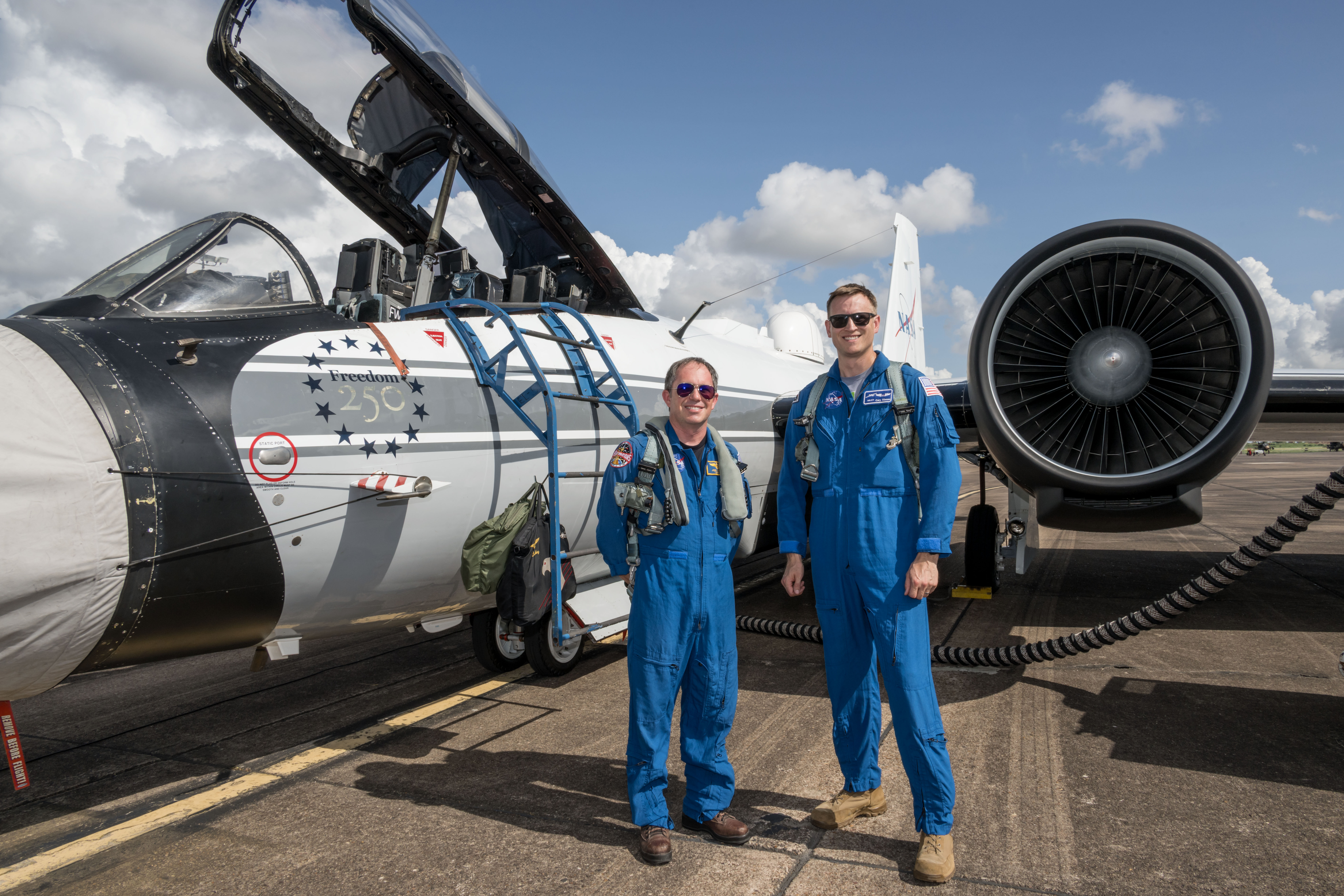
NASA’s WB-57F aircraft prepares for takeoff from Ellington Field in Houston ahead of its mission to observe the Aug. 12, 2026, total solar eclipse from Iceland. From left are John Gustine, NASA WB-57F pilot, and Cary Klemm, sensor equipment operator for NASA’s WB-57F.
NASA/Robert Markowitz
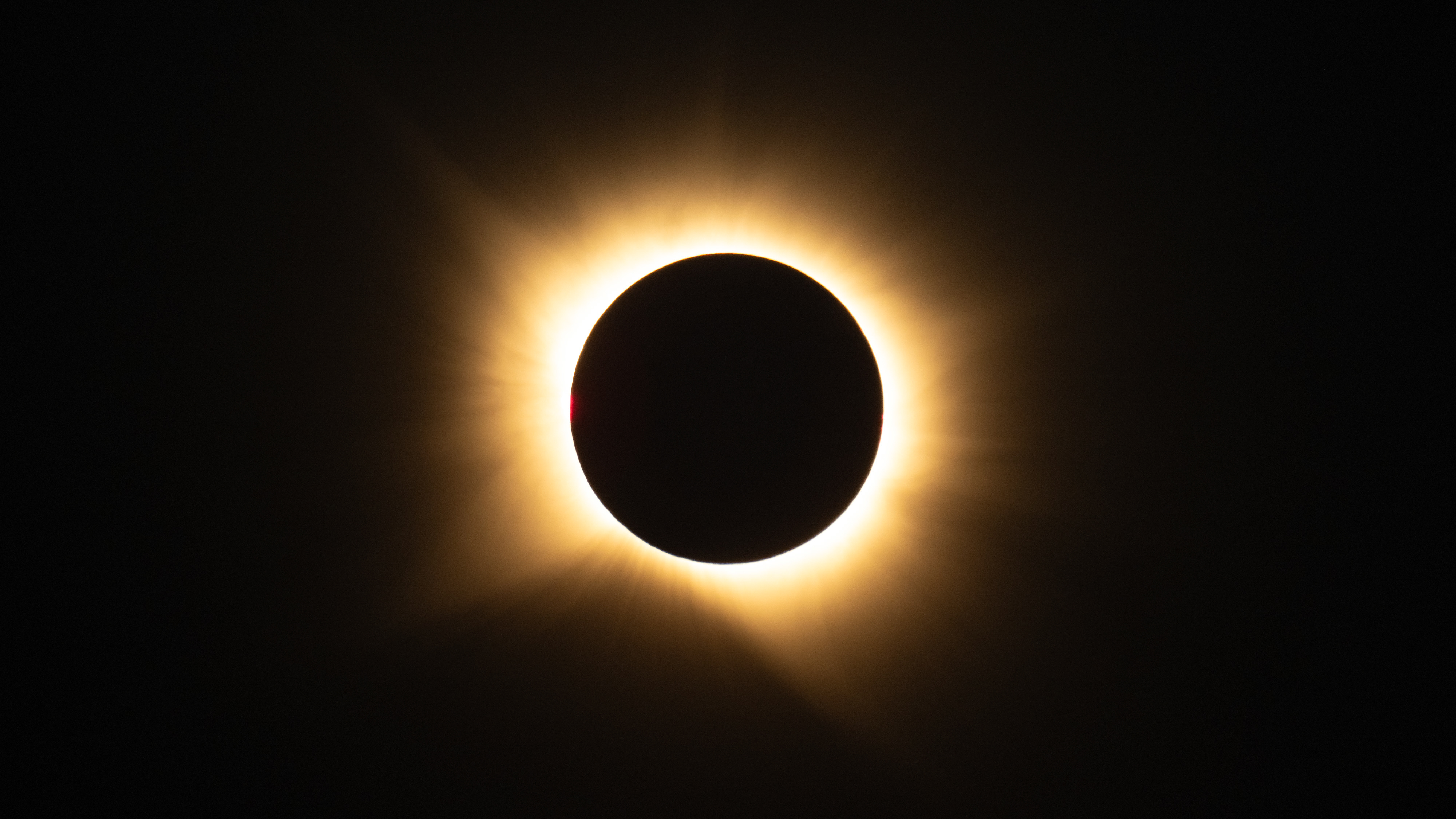
During the Aug. 12 total solar eclipse over Europe, scientists aimed to study a long-standing mystery: why the Sun’s outer atmosphere, the corona, is far hotter than its visible surface. Capturing the data they needed meant being in exactly the right place at the right time.
Pilots from NASA’s Johnson Space Center flew the WB-57F high altitude research aircraft from Ellington Field in Houston to Iceland, their base for flying through the path of totality to give scientists a clearer view of the Sun’s corona.
A total solar eclipse provides a unique opportunity to examine the corona because the Moon temporarily blocks the Sun’s bright surface, revealing its fainter outer atmosphere. Observations collected during this brief window can help scientists better understand how energy and material move through the corona and away from the Sun, improving our understanding of space weather.
John Gustine, NASA WB-57F pilot, prepares for flight at Ellington Field in Houston ahead of the aircraft’s departure for Iceland to support the Aug. 12 total solar eclipse.
NASA/Robert Markowitz
At about 50,000 feet, the WB-57F flew above most clouds, dust, and water vapor that can interfere with observations from the ground. The altitude reduced atmospheric interference while also allowing the science instruments to observe infrared wavelengths that are largely absorbed lower in Earth’s atmosphere.
Capturing those observations required careful coordination between scientists and the flight crew. Before the mission, teams calculated where the aircraft needed to be as the Moon’s shadow moved across the North Atlantic.
“Going into a mission like this takes a huge team. It starts with the science team establishing the requirements, and then we work closely with them for months leading up to the mission,” said Tom Parent, NASA WB-57F pilot. “We rely heavily on our maintenance team to get the instruments serviced, prepared, loaded onto the aircraft, and flight tested. It’s a huge team effort to get an aircraft like this up there to image and achieve these objectives.”
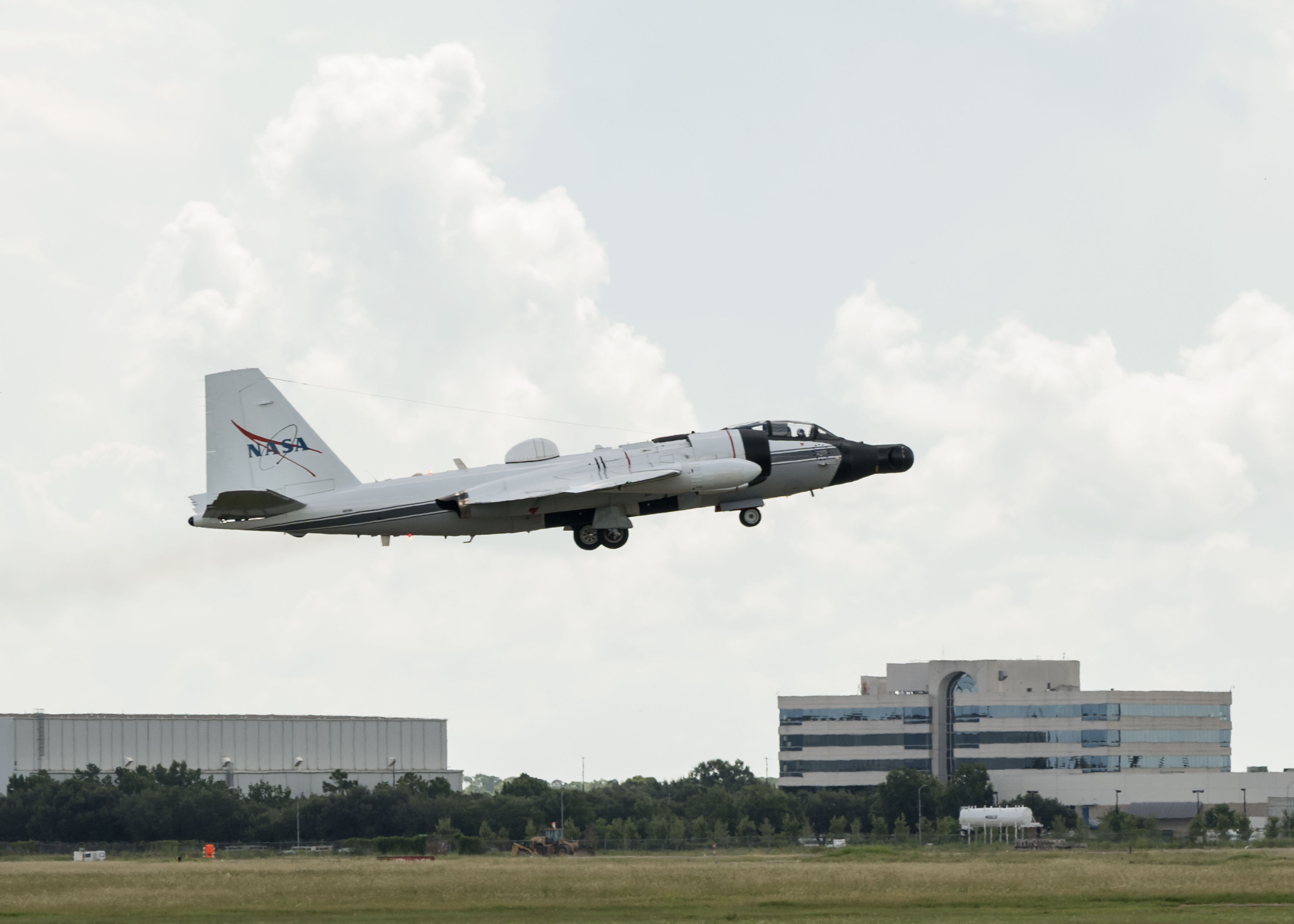
NASA’s WB-57F aircraft takes off from Ellington Field in Houston ahead of its mission supporting the Aug. 12 total solar eclipse from Iceland.
NASA/Robert Markowitz
During totality, NASA WB-57F pilot John Gustine positioned the aircraft along the eclipse path to maximize time in the Moon’s shadow and give scientists as much opportunity as possible to collect data.
From the back seat, Cary Klemm, sensor equipment operator for NASA’s WB-57F, controlled the camera systems, adjusting focus and exposure times while tracking features of interest throughout totality.
With the cameras capturing observations throughout the brief window, every second mattered.
“Every image is another piece of data that could reveal something new about the Sun,” Klemm said.
What scientists can learn from those observations reaches far beyond the eclipse itself. The Sun’s corona is made of plasma shaped by magnetic fields, and many of the same physical processes occur elsewhere in the universe.
“The NASA WB-57F’s unique capabilities of high-altitude flight were truly crucial in providing access to these valuable wavelengths during an eclipse whose path crossed mostly over the ocean in an area where clouds are common,” said Amir Caspi, principal investigator for the study at Southwest Research Institute in Boulder, Colorado. “We could not have achieved this success without this platform, and all of the efforts of the many intrepid ground, air, and science crew members.”
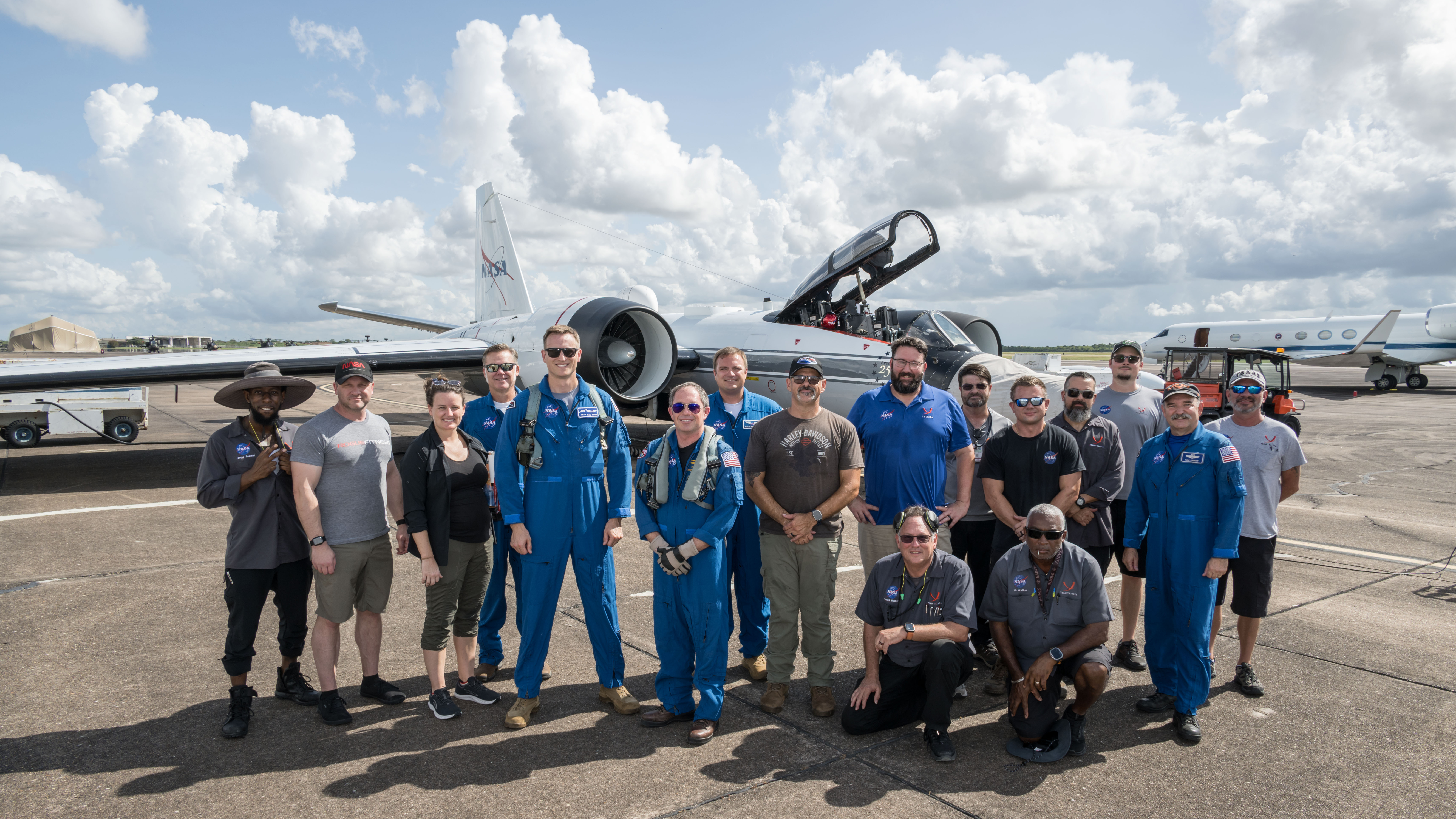
Members of NASA’s WB-57F eclipse mission team gather at Ellington Field in Houston ahead of the aircraft’s departure for Iceland.
NASA/Robert Markowitz
The data gathered during the flight will give scientists another opportunity to investigate the Sun and the processes that influence the space environment around Earth.
The rugged terrain of the Silver Island Mountains and Crater Island rises above the pale playa and bright salt flats of former Lake Bonneville. The image was acquired with the OLI (Operational Land Imager) on Landsat 8 on June 4, 2026, and overlaid on a digital elevation model.
NASA Earth Observatory/Michala Garrison
At its peak, ancient Lake Bonneville would have been a sight to behold. Nearly as large as Lake Michigan, the Ice Age lake spread across much of western Utah and parts of Nevada and Idaho. When it eventually receded, it left behind flat, bright playas and salt flats rich with minerals—a landscape that would later serve as the setting for feats of engineering and technological ingenuity, as well as epic tales of exploration and desperation.
Lake Bonneville began forming about 55,000 years ago during a cool, wet period, when volcanic eruptions in what’s now southeastern Idaho diverted the Bear River, causing water to gather in Gem Valley and other basins to the south. For tens of thousands of years, a natural dam at Red Rock Pass helped confine the lake.
Then, about 18,000 years ago, water breached that dam, unleashing a torrent that entered the Columbia River system. Over a six-week period, amid one of North America’s largest floods, lake levels plummeted by more than 350 feet (105 meters). As the climate warmed and dried in subsequent millennia, the lake shrank dramatically, leaving remnants that include today’s Great Salt Lake, Utah Lake, and Sevier Lake.
Lake Bonneville may be gone, but its imprint on the region’s landscape remains—even in satellite imagery. In this image (below) captured by the OLI (Operational Land Imager) on the NASA-USGS Landsat 8 satellite, bathtub-like rings and wave-cut terraces trace the position of former shorelines. The dried lakebed—where fine-grained clay, marl, and sandy sediment settled out of the water—appears pale in comparison to the darker, rockier, more vegetated surroundings.
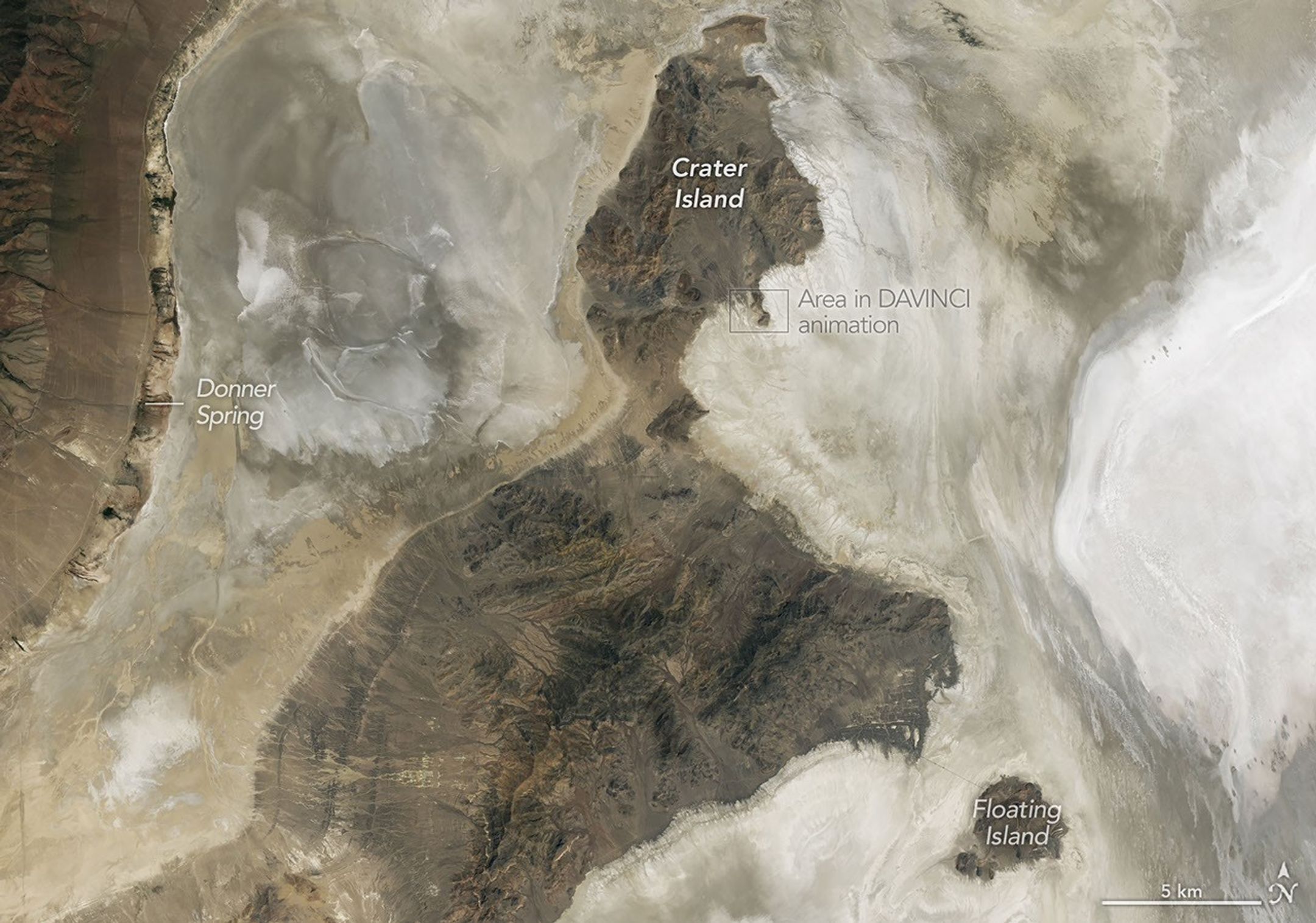
NASA scientists analyzed the terrain in this part of Utah when testing technologies that will be used on NASA’s DAVINCI mission to Venus. This image was acquired with the OLI (Operational Land Imager) on Landsat 8 on June 4, 2026.
NASA Earth Observatory/Michala Garrison
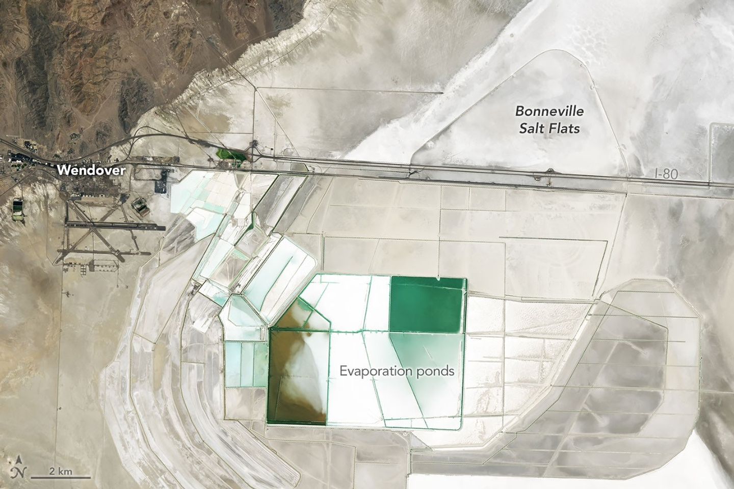
In deep parts of the basin, where runoff and groundwater still pool, bright deposits of evaporite minerals coat the land surfaces, forming salt flats. These remarkably flat surfaces are the product of water gradually evaporating and concentrating minerals to produce brines and hard mineral crusts, typically including halite and gypsum, along with potassium- and magnesium-bearing salts. Brines and deposits like these—particularly of potash, which is used as a fertilizer—have long made the playa a target for mining, as seen in the rectangular evaporation ponds above and below.
In contrast, the darker, more rugged terrain—including the Silver Island Mountains, the Newfoundland Mountains, and the Pilot Range—that rises above the playas is built from layers of erosion-resistant sedimentary and metasedimentary bedrock that is hundreds of millions of years old. These mountains also contain younger igneous and metamorphic rocks that formed when magma intruded into the ancient sedimentary sequence.
Crater Island, for instance, is composed of sedimentary rocks, including silica-rich sandstones and quartzites that formed as sands accumulated in a shallow ocean, as well as intrusions of quartz monzonite, granites, and other igneous rocks. Periods of crustal stretching later produced the fault-block mountains that define the landscape.
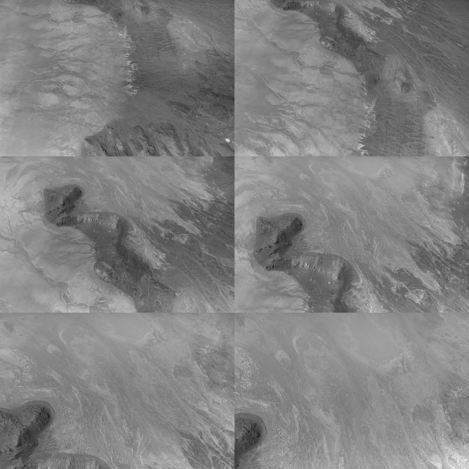
This animation shows the descent over Crater Island, Utah, of the camera system that will one day fly aboard NASA’s DAVINCI mission to Venus. It was created by stitching together 37 infrared images captured during a test on June 24, 2026.
Malin Space Science Systems/NASA/Jay Friedlander
Mapping geological distinctions like this took center stage in June 2026 when NASA scientists and engineers working with the agency’s DAVINCI mission came to Crater Island—a place they call “Venus on Earth”—to field-test the design of a set of cameras and a package of instruments that will eventually descend through the thick atmosphere of Venus and photograph mountains at scales finer than these Landsat images. During a 60-minute descent, the pioneering probe will capture near-infrared images, measure the atmospheric chemistry, and explore the environment of a world in unprecedented detail.
During the rehearsals at Crater Island, the camera system took hundreds of images of various rock formations, including iron-rich and silica-rich rock units, while suspended from a helicopter as it descended toward the surface. Using only the images acquired by DAVINCI’s camera systems, the team made three-dimensional maps of the area consistent with existing geologic maps, giving the scientists confidence that they will be able to map the geology of an analogous mountainous region on Venus that DAVINCI will study, an area called Alpha Regio.
Other epic adventures have played out on and around Lake Bonneville’s playas, as well. The flat, smooth surfaces have often been the setting for new land speed records. In 1960, Mickey Thompson became the first American to break the 400-miles-per-hour (640 kilometers-per-hour) barrier, hitting 406.60 miles per hour (654.36 kilometers per hour) in a streamlined race car on the Bonneville Salt Flats. The feat temporarily earned him the nickname “fastest man on Earth.”
People mine minerals from the Bonneville Salt Flats and use its flat surface to pursue land speed records. This image was acquired with the OLI (Operational Land Imager) on Landsat 8 on June 4, 2026.
NASA Earth Observatory/Michala Garrison
More recently, in August 2026, Andy Green, the first person to break the sound barrier on land, set a record for the fastest land speed in a hydrogen-fueled internal-combustion vehicle, reaching 406.320 miles per hour (653.909 kilometers per hour). By burning hydrogen rather than gasoline, the “rocket car” produced no carbon dioxide.
Nearly two centuries earlier, in August 1846, members of the ill-fated Donner-Reed Party also passed along the southern edge of Crater Island. As part of a shortcut toward Pilot Peak, they journeyed from Hastings Pass, past Floating Island, and toward Donner Spring. However, in an ominous sign of challenges to come, their heavy wagons broke through the thin salt crust and became mired in underlying mud, slowing them down and prompting them to abandon several wagons in the desert.
NASA Earth Observatory images by Michala Garrison, using Landsat data from the U.S. Geological Survey.Story by Adam Voiland.
NASA Shares Views of August Solar Eclipse from Ground, Air, Space
This composite image shows the progression of a total solar eclipse as the Sun sets over San Millán de los Caballeros, Spain, on Wednesday, Aug. 12, 2026.
Credits: NASA/Bill Ingalls
On Aug. 12, a total solar eclipse darkened skies over Greenland, Iceland, and Spain. As the Moon covered the Sun, it briefly revealed the Sun’s wispy outer atmosphere — the corona — to those in the path of totality who were lucky enough to have clear skies. NASA researchers and photographers were along the eclipse path to study the corona, capture the phenomenon, and observe how the eclipse affected our planet.
One NASA photographer in Spain captured the total solar eclipse as well as the partial phases before and after, until the Sun set below the horizon.
This composite image shows the progression of a total solar eclipse over a field of sunflowers in San Millán de los Caballeros, Spain, on Aug. 12, 2026. Credit: NASA/Bill Ingalls
The solar corona appears in this photograph of a total solar eclipse captured from San Millán de los Caballeros, Spain, on Aug. 12, 2026. Credit: NASA/Bill Ingalls
A solar prominence, a plume of electrically charged gas suspended above the Sun by strong magnetic forces, appears as a pink feature along the left edge of the eclipsed Sun in this photograph taken from San Millán de los Caballeros, Spain, on Aug. 12, 2026. Credit: NASA/Bill Ingalls
This composite image shows the progression of a total solar eclipse as the Sun sets in San Millán de los Caballeros, Spain, on Aug. 12, 2026. Credit: NASA/Bill Ingalls
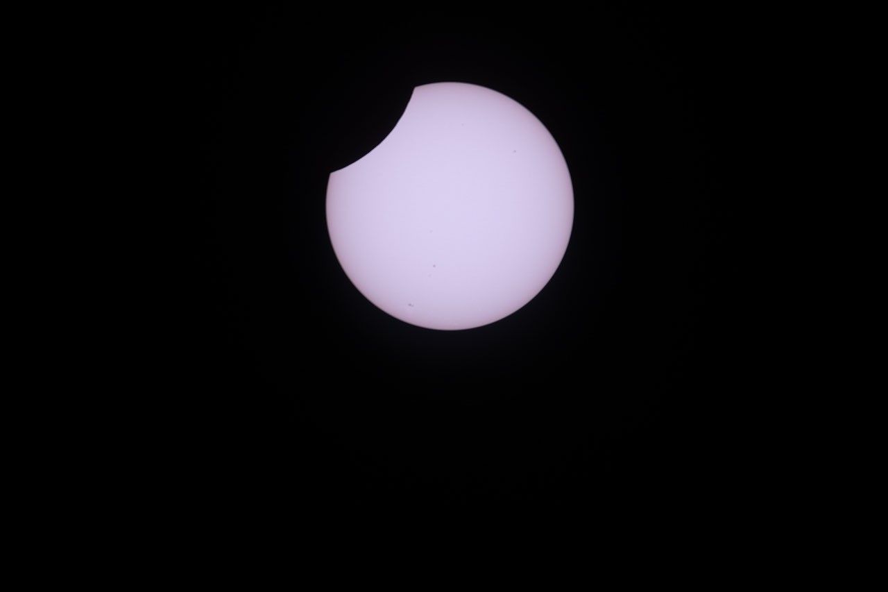
In northern Maine, where only a partial eclipse was visible, another NASA photographer captured the International Space Station, with its crew of seven aboard, speeding past the partially eclipsed Sun.
In this image of a partial solar eclipse, which is veiled by clouds, the International Space Station, with a crew of seven aboard, appears in silhouette as it transits at roughly five miles per second on Aug. 12, 2026, as seen near Hodgdon, Maine. Aboard the station as part of Expedition 75 are NASA astronauts Jessica Meir, Anil Menon, and Jack Hathaway; ESA (European Space Agency) astronaut Sophie Adenot; and Roscosmos cosmonauts Pyotr Dubrov, Andrey Fedyaev, and Anna Kikina. Credit: NASA/Joel Kowsky
Twelve frames assembled in sequence show the International Space Station, with a crew of seven aboard, in silhouette as it transits the Sun at roughly five miles per second during a partial solar eclipse on Aug. 12, 2026, as seen near Hodgdon, Maine. Clouds partially obscure the view of the Sun. Aboard the station as part of Expedition 75 are NASA astronauts Jessica Meir, Anil Menon, and Jack Hathaway; ESA (European Space Agency) astronaut Sophie Adenot; and Roscosmos cosmonauts Pyotr Dubrov, Andrey Fedyaev, and Anna Kikina. Credit: NASA/Joel Kowsky
Meanwhile, from about 250 miles above the ground, a NASA astronaut aboard the International Space Station snapped a few photos of the partial eclipse from their perspective as well.
NASA astronaut Jessica Meir captured this photo of the partial solar eclipse from the International Space Station on Aug. 12, 2026, as the orbital outpost soared 262 miles above southern Quebec, Canada. From the station, the Moon covered about 18% of the Sun at the peak of the eclipse. Credit: NASA/Jessica Meir
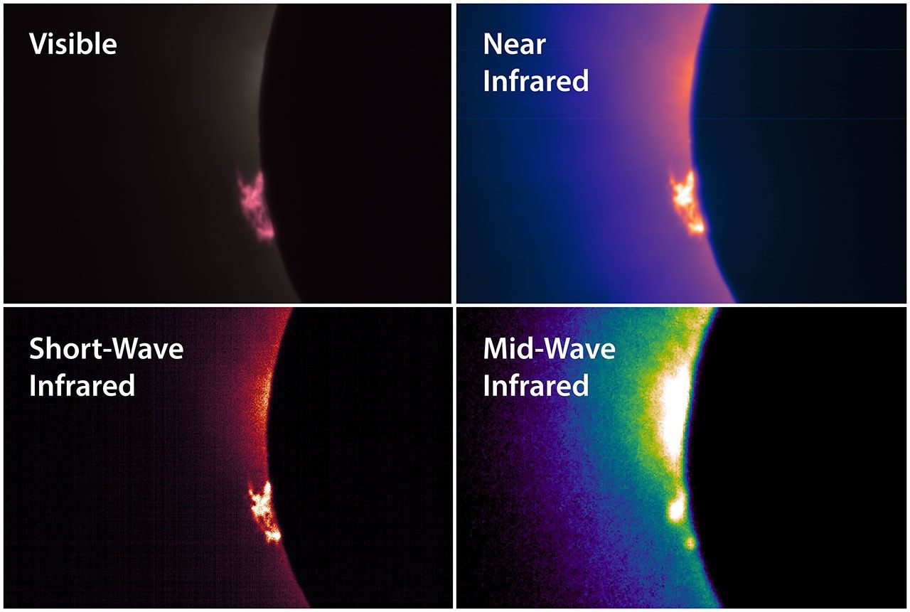
Between the ground and the space station, NASA pilots flew NASA’s WB-57F research jet at an altitude of 50,000 feet, passing through the eclipse’s shadow to lengthen their time in the eclipse. The jet carried a suite of cameras that captured high-resolution images of the corona and prominences, plumes of electrically charged gas rising off the Sun, in several different wavelengths of light.
The total solar eclipse on Aug. 12, 2026, was captured by a camera mounted inside the cockpit window of NASA’s WB-57F aircraft as it flew around 50,000 feet altitude off the coast of Iceland.
NASA
A suite of cameras installed on NASA’s WB-57F aircraft captured images of the solar corona and prominences in different wavelengths of visible and infrared light during the total solar eclipse on Aug. 12, 2026. A science team led by the Southwest Research Institute in Boulder, Colorado, will analyze the images to learn more about complex and dynamic features in the Sun’s outer atmosphere. Credit: NASA/SwRI/Will Ashfield
In both Iceland and Spain, teams of students participating in the NASA-funded Nationwide Eclipse Ballooning Project launched scientific balloons that carried instruments to capture images of the eclipse’s shadow and study the eclipse’s effects on our atmosphere. Even though clouds obscured the view of the eclipse from the ground in Iceland, the weather did not interfere with the balloon-borne instruments’ ability to gather information about how the brief loss of light and heat affected the lower atmosphere.
Students participating in the NASA-funded Nationwide Eclipse Ballooning Project prepare to launch a scientific balloon in Mosfellsbær, Iceland, during the total solar eclipse on Aug. 12, 2026. Credit: NASA/Abbey Interrante
The Moon’s shadow passes over the atmosphere during the total solar eclipse on Aug. 12, 2026. The video was taken by a camera carried by a scientific balloon launched from Spain by a student team from Montana State University participating in the NASA-funded Nationwide Eclipse Ballooning Project. The video captures about six minutes of time but is sped up to play at four times real speed. Passing through the foreground are some other science instruments carried by the same balloon.
Nationwide Eclipse Ballooning Project/Montana State University
Before the eclipse, scientists at Predictive Science Inc., with support from NASA grants and supercomputers, used observations of the Sun from NASA spacecraft and ground-based telescopes to predict what the corona would look like during the eclipse. Below, their corona prediction is compared to a composite image of the corona, which combines multiple images captured by the NASA-supported DEB Initiative project during the total eclipse near León, Spain.
prediction
image
This image shows a prediction from the morning of Aug. 12, 2026, of what the solar corona would look like to the human eye during the total solar eclipse that day.
Predictive Science Inc.
This processed, composite image of the corona combines multiple images captured near León, Spain, during the total solar eclipse on Aug. 12, 2026.
DEB Initiative Team/Zack Stockbridge
This image shows a prediction from the morning of Aug. 12, 2026, of what the solar corona would look like to the human eye during the total solar eclipse that day.
Predictive Science Inc.
This processed, composite image of the corona combines multiple images captured near León, Spain, during the total solar eclipse on Aug. 12, 2026.
DEB Initiative Team/Zack Stockbridge
prediction
image
The left image shows a prediction from the morning of Aug. 12, 2026, of what the solar corona would look like to the human eye during the total solar eclipse that day. The right image is processed, composite image of the corona that combines multiple images captured near León, Spain, during the total solar eclipse on Aug. 12, 2026. Left image credit: Predictive Science Inc.; right image credit: DEB Initiative Team/Zack Stockbridge
Over the coming months, scientists will analyze the observations and images captured during the solar eclipse on Aug. 12 and present what they have learned about the Sun and its effects on our home planet. These observations will also help prepare science teams to investigate future solar eclipses, such as a much longer total solar eclipse that will be visible from southern Spain and northern Africa on Aug. 2, 2027.
A total solar eclipse is seen from San Millán de los Caballeros, Spain, Wednesday, Aug. 12, 2026. A total solar eclipse – the Moon passing between the Sun and Earth, completely blocking the face of the Sun – swept across parts of Greenland, Iceland, northern Russia, the Atlantic Ocean, Spain, and a small corner of Portugal. A partial eclipse was visible in parts of the U.S., most of Canada, much of Europe, and northwest Africa.

 Login
Login